Punch Bowl
Ventura County, California
Your visit at a glance
- Waterfall height
- Not recorded
- Location
- Ventura County, California
- Access status
- Partial guide: probable match; pass rules and current trail start not confirmed
- The walk
- About 8 miles return (source figure)
- Ground & access
- Creek crossings, rocky canyon bottom and some steep side-canyon trail. Deep pools; flood damage reported in places.
Start at the Santa Paula Canyon Trail parking on Highway 150 near Thomas Aquinas College. Hikespeak lists a newer trail along the creek and older directions around the campus and through ranch land. Follow Santa Paula Canyon Trail up the canyon to Big Cone Camp, then descend to the Punchbowl falls and pools. The Forest Service map also labels a separate rock feature The Punch Bowl east of the river, so the match to this listing is probable, not confirmed.
Plan your visit
Santa Paula Canyon Trail from Highway 150 near Thomas Aquinas College to Big Cone Camp and the Punchbowl
Hikespeak gives an 8-mile round trip from Route 150 to Big Cone Camp and the Punchbowl, with the falls at about 3.85 miles in its turn-by-turn directions.
Creek crossings, rocky canyon bottom and some steep side-canyon trail. Deep pools; flood damage reported in places.
Where to start
Hikespeak describes a newer parking area on the north side of Route 150 just east of the Thomas Aquinas College entrance. Current pass rules not confirmed.
Timing & water
Year-round stream; high water after storms makes crossings dangerous.
Before you go
Current Los Padres National Forest pass requirement not confirmed. The first part of the route crosses private college and ranch land; stay on the signed trail.
Visitor informationVisit sources
More waterfalls nearby
Within 40 straight-line miles. Road and trail distances will differ.
- Jackson FallsVentura County, CA0.8 miN
- White Swift Falls59 ft (18 m) · Ventura County, CA2.3 miN
- Rose Valley FallsResearched route and starting areaVentura County, CA8.7 miNW
- 33 FallsVentura County, CA13 miNW
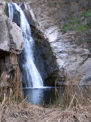 Paradise FallsSigned park trail; check current COSCA closures70 ft (21.4 m) · Ventura County, CA19 miSE
- Sycamore FallsOfficial brochure route and trailhead parking documentedVentura County, CA23 miS
- Escondido Falls (Upper)Los Angeles County, CA33 miSE
- Escondido Falls (Lower)Official MRCA park route; upper falls closed to the publicLos Angeles County, CA33 miSE
- Hot Springs FallsSanta Barbara County, CA33 miW