Hot Springs Falls
Santa Barbara County, California
Your visit at a glance
- Waterfall height
- Not recorded
- Location
- Santa Barbara County, California
- Ground elevation
- About 1,060 ft above sea level
- Nearby mapped stream
- Hot Springs Creek
- Land
- Los Padres National Forest
- Nearby mapped access
- Unnamed trailhead
A nearby mapped parking area or trailhead may not connect to this waterfall. Confirm the route and public access before travelling.
Hot Springs Falls is mapped in Santa Barbara County, California, 1.5 miles north of Montecito. This entry shows its location and nearby mapped places; a visitor route has not been confirmed.
About this location
Land & access
The land ownership record at this location lists Los Padres National Forest. The listed manager is U.S. Forest Service. The land record lists public access. Check the manager’s current visitor information for permitted routes and closures.
Nearby named trails
- Hot Springs Fireroad
- Hot Springs Trail
These paths are mapped within 250 metres (about 820 feet) of the waterfall. A connection to a viewpoint has not been verified.
Water & terrain
Hot Springs Creek is mapped within 60 metres (about 200 feet) of the waterfall. Proximity alone does not confirm which stream feeds the falls.
Ground elevation is the land’s height above sea level, not the waterfall’s drop.
Sources for these details
Nearby streams and paths: OpenStreetMap. Land names: USGS PAD-US ownership records, with planning boundaries used only where ownership has no usable name. Ground elevation: USGS 3D Elevation Program.
Map records do not verify a walking route or current access conditions.
Before you make the trip
The closest mapped trailhead is 0.7 mi away in a straight line. This is not a walking distance.
Trail length, parking rules and current conditions have not been confirmed for this entry.
More waterfalls nearby
Within 40 straight-line miles. Road and trail distances will differ.
- Tangerine FallsVisitor route and parking documented; unmaintained final sectionSanta Barbara County, CA1.4 miNW
- Seven FallsTrail organization route and parking documented; creek scrambleSanta Barbara County, CA4.0 miW
- Wellhouse FallsSanta Barbara County, CA9.8 miNW
- Sisquoc FallsSanta Barbara County, CA20 miN
- 33 FallsVentura County, CA22 miE
- Rose Valley FallsResearched route and starting areaVentura County, CA27 miE
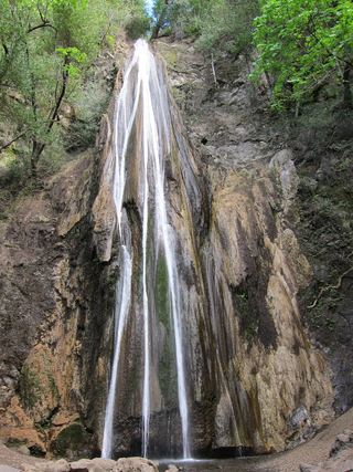 Nojoqui FallsPublished county park route and parking documentedSanta Barbara County, CA31 miW
- Punch BowlPartial guide: probable match; pass rules and current trail start not confirmedVentura County, CA33 miE
- White Swift Falls59 ft (18 m) · Ventura County, CA33 miE