Moose Falls
Teton County, Wyoming
Your visit at a glance
- Waterfall height
- 30 ft (9.1 m)
- Location
- Teton County, Wyoming
- Access status
- Researched walking route
- The walk
- About 0.25 mile return
- Ground & access
- Dirt singletrack; steep, rugged and slippery descent beyond the upper view. Multiple social paths are reported.
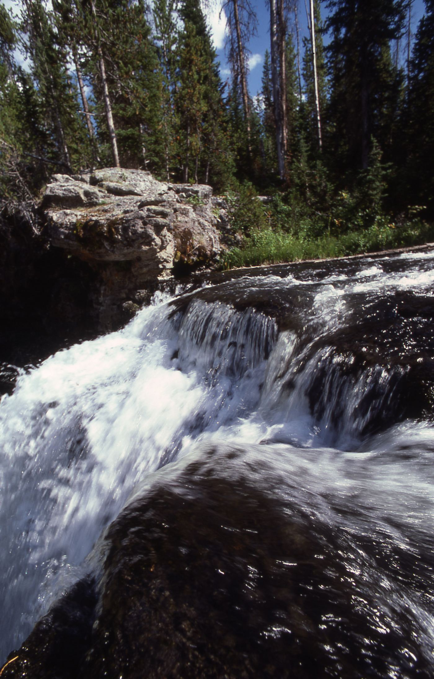
Photo credit
Photo: J. Schmidt, Public domain, via Wikimedia CommonsShort walk to Crawfish Creek’s waterfall, with a rougher descent to its base.
Plan your visit
From the Moose Falls pulloff, follow the dirt path through the woods about 350 feet to the upper viewing area. The photographed firsthand report continues down a steep, slippery path to the base and returns the same way; stopping at the upper view avoids that descent.
Anne’s Travels reports 0.25 mile total including the base, with 98 feet of elevation gain. This is a firsthand recorded walk, not an official NPS trail length. Upper viewpoint only is shorter.
Dirt singletrack; steep, rugged and slippery descent beyond the upper view. Multiple social paths are reported.
Where to start
Roadside pulloff 1.2 miles north of the South Entrance station, on the right when driving north. Firsthand trailhead coordinates: 44.152021, -110.673609.
Timing & water
South Entrance Road is typically open May–October according to National Parked. Check NPS road conditions for the visit date.
Before you go
Park entrance admission applies. Current fees and any additional requirements were not verified.
Visitor informationMore waterfalls nearby
Within 40 straight-line miles. Road and trail distances will differ.
 Lewis FallsOfficial viewing facilities identified; post-construction pedestrian approach unconfirmed30 ft (9.1 m) · Teton County, WY8.2 miN
- Cascade Creek FallsPartial: short informal use trail beside the trailhead; unofficial nameTeton County, WY8.8 miW
- Cascade AcresYellowstone backcountry trail from the Cascade Creek Trailhead on Grassy Lake Road; Cascade Acres is passed on the way to Terraced FallsTeton County, WY9.1 miW
- Polar Bear7 ft (2 m) · Teton County, WY9.4 miW
 Terraced FallsShort signed national park trail from a Grassy Lake Road trailheadTeton County, WY9.6 miW
 Union FallsResearched visit notesTeton County, WY10 miW
- Wahhi FallsTeton County, WY13 miNW
- Sluiceway FallsTeton County, WY13 miNW
- Gwinna FallsTeton County, WY14 miNW