Upper Falls of Seneca Creek
Pendleton County, West Virginia
Your visit at a glance
- Waterfall height
- Not recorded
- Location
- Pendleton County, West Virginia
- Access status
- National forest trail to the falls; creek crossings without footbridges; access road not maintained in winter
- The walk
- 5 miles each way per TrailLink; Mon Forest Towns lists a 10.1-mile out-and-back route
- Ground & access
- Dirt trail on a former railroad grade, average grade about 3 percent. Several creek crossings with no footbridges, so expect wet feet.
Upper Seneca Creek Falls is a 30-foot falls, the highest on Seneca Creek, at the end of the Seneca Creek Trail in the Monongahela National Forest. From the trailhead on Forest Road 112, the trail follows a former logging railroad grade down along Seneca Creek, first through meadows and spruce groves, then hardwood forest. It is mostly gentle, with a high point of 3,875 feet and a low point of 3,128 feet. There are several creek crossings with no footbridges; the last one brings you to the falls. Smaller waterfalls are passed along the way. Return the same way, or make a longer loop on other trails of the Spruce Knob-Seneca Creek backcountry.
Plan your visit
Seneca Creek Trailhead on Forest Road 112, down the Seneca Creek Trail (TR515) along Seneca Creek to Upper Seneca Creek Falls at the trail's end
TrailLink lists the Seneca Creek Trail as 5 miles long with its end points at Forest Road 112 and Upper Seneca Creek Falls. Mon Forest Towns calls it a 10.1-mile out-and-back route.
Dirt trail on a former railroad grade, average grade about 3 percent. Several creek crossings with no footbridges, so expect wet feet.
Where to start
Seneca Creek Trailhead on the right side of Forest Road 112, about 11 miles in from Briery Gap Road (County Road 33), which leaves US 33 south of Elkins. Limited parking. Forest Road 112 is steep, narrow gravel and is not maintained in winter.
Timing & water
Mon Forest Towns says the trail is accessible year-round but best from March until November. Forest Road 112 is not maintained in winter.
Before you go
No fee is mentioned.
Visitor informationVisit sources
More waterfalls nearby
Within 40 straight-line miles. Road and trail distances will differ.
- Small waterfallPendleton County, WV0.3 miN
- Falls of SenecaPendleton County, WV3.6 miN
- High Falls of CheatLong trail over Shavers Mountain and a walk beside railroad tracks to the fallsPocahontas County, WV14 miW
- High FallsSource-reviewed trail and parking20 ft (6 m) · Randolph County, WV15 miW
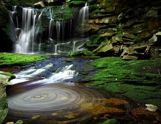 Elakala FallsShort state park trail to a bridge over the first fallsTucker County, WV23 miN
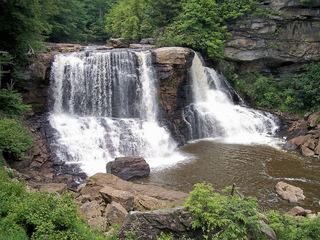 Blackwater FallsRoute and parking documented; confirm current conditions.62 ft (19 m) · Tucker County, WV24 miN
- Douglas FallsTucker County, WV25 miN
- Albert FallsPartial guide: the falls is seen from a rail-trail; the exact viewing spot and the distance from parking are not statedTucker County, WV25 miN