Debord Falls
Morgan County, Tennessee
Your visit at a glance
- Waterfall height
- Not recorded
- Location
- Morgan County, Tennessee
- Access status
- State park trail route and trailhead documented
- The walk
- Just over 0.5 mile to the spur, then a couple hundred feet to the falls (one way)
- Ground & access
- Wide two-track dirt trail on an old road with a gradual climb. Steps down to the viewing area.
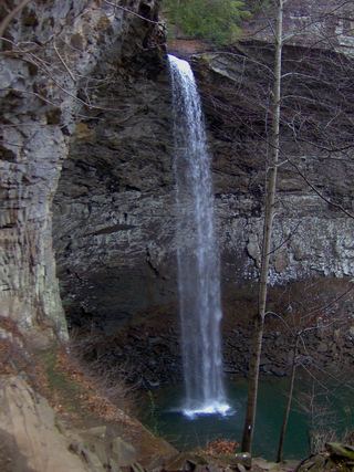
Debord Falls is a ledge waterfall of about 10 feet with a large plunge pool on Panther Branch in Frozen Head State Park. From the back of the Panther Branch Trailhead parking lot, follow the Panther Branch Trail (blue markers), a wide old road that climbs gradually with the creek below on the right. Just past 0.5 mile, take the signed spur to the right. A couple hundred feet later, steps lead down to a viewing area at the base of the falls. Return the same way, or continue up the main trail to Emory Gap Falls.
Plan your visit
Panther Branch Trailhead at the end of the main park road, Panther Branch Trail, then the signed spur to Debord Falls
The Parking Full Time Hiking account reaches the signed Debord Falls spur just past 0.5 mile from the trailhead and the falls a couple hundred feet later. Its 2.6-mile figure is for an out-and-back that also visits Emory Gap Falls.
Wide two-track dirt trail on an old road with a gradual climb. Steps down to the viewing area.
Where to start
Panther Branch Trailhead, a large paved lot for about 25 cars at the end of the main park road. From the junction of SR 62 and US 27 in Wartburg, take SR 62 east 1.5 miles to Flat Fork Road at the brown park sign, then follow the park road past the Visitor Center and over a one-lane bridge to its end.
Timing & water
No seasonal closure is mentioned. A sign at the trailhead gives the park closing time.
Before you go
No fee is mentioned.
Visitor informationVisit sources
More waterfalls nearby
Within 40 straight-line miles. Road and trail distances will differ.
- Emory Gap FallsState park trail route and trailhead documentedMorgan County, TN0.5 miNE
 Ozone FallsResearched walking route112 ft (34 m) · Cumberland County, TN26 miSW
 Angel FallsNational park trail and trailhead documentedScott County, TN26 miN
- Ray FallsRhea County, TN32 miSW
- Upper Piney Falls 80Guide: state natural area trail to the falls and ledgeRhea County, TN35 miSW
- Lower Piney Falls 40Rhea County, TN36 miSW
- Big Spring FallsSigned trail and spur to viewing deck from Blue HeronMcCreary County, KY36 miN
- Stinging Fork Falls 60State natural area trail and parking documentedRhea County, TN38 miSW
- Keaton FallsBledsoe County, TN39 miSW