Green Peak Falls
Benton County, Oregon
Your visit at a glance
- Waterfall height
- Not recorded
- Location
- Benton County, Oregon
- Access status
- Trail from a signed park parking area documented
- The walk
- About half a mile to the falls
- Ground & access
- Easy forest trail with a footbridge and a wooden staircase at the end. High water can make full views harder.
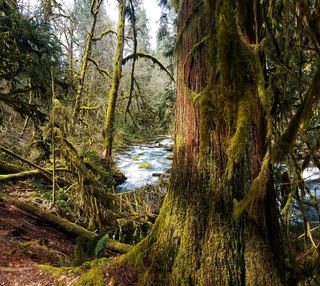
Green Peak Falls is a 45-foot falls on Peak Creek in Hubert K. McBee Memorial Park, land the Hull-Oakes timber company has set aside for public use. From the signed Green Peak Falls parking area, follow the trail along and above Peak Creek, cross a footbridge, and reach the falls. A wooden staircase leads down to the creek. Return the same way. Do not use the old steep bushwhack route described in older guidebooks.
Plan your visit
Hubert K. McBee Memorial Park parking to the base of Green Peak Falls
Both the Northwest Waterfall Survey and Oregon Hikers give about half a mile from McBee Park to the falls. The figure is one way.
Easy forest trail with a footbridge and a wooden staircase at the end. High water can make full views harder.
Where to start
From Alsea, go south toward Alsea Falls, turn left on South Fork Road and drive about 8 miles (partly gravel) to Hubert K. McBee Memorial Park. Turn into the campground, cross the river, and park in the signed Green Peak Falls parking area. From Monroe, follow Alpine Road and the signs to Alsea Falls, then continue 0.6 mile to the park entrance.
Timing & water
No season dates are given for McBee Park. The falls are easier to view, though smaller, in the low-water season.
Before you go
No fee is mentioned for McBee Park. The nearby BLM Alsea Falls day-use area, an alternative start, charges $5 when open.
Visitor informationVisit sources
More waterfalls nearby
Within 40 straight-line miles. Road and trail distances will differ.
 Alsea FallsShort walk and steps from the day-use area; seasonal gateBenton County, OR0.7 miS
- Waters of MormonBenton County, OR4.1 miE
- Upper Kentucky FallsForest trail to a viewpoint and the base documented289 ft (88 m) · Douglas County, OR32 miSW
- North Fork FallsForest trail to a viewing deck and creek view documented410 ft (125 m) · Douglas County, OR32 miSW
- Lower Kentucky FallsForest trail to a viewing deck at the base384 ft (117 m) · Douglas County, OR32 miSW
- Homestead FallsLane County, OR33 miSW
- Punchbowl Canyon FallsLane County, OR33 miSW
- Annice FallsLane County, OR33 miSW
- Elk Wallow FallsLane County, OR33 miSW