Camp Benson Falls
Hood River County, Oregon
Your visit at a glance
- Waterfall height
- 85 ft (25.9 m)
- Location
- Hood River County, Oregon
- Access status
- Partial guide: the last section uses a powerline maintenance road that is not confirmed as an official trail
- The walk
- About 4.9 miles round trip, per Oregon Hikers
- Ground & access
- Paved state trail, then a gravel powerline maintenance road. Alder trees hide the lower part of the falls when they are in leaf. Poison oak.
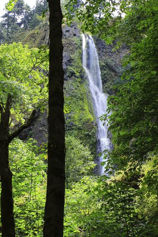
Camp Benson Falls drops about 90 feet on Summit Creek. From the Starvation Creek Trailhead, walk west beside the freeway on the paved Historic Columbia River Highway State Trail, past Cabin Creek Falls, the Hole in the Wall Falls junction and the Lindsey Creek crossing. Where a gravel powerline maintenance road crosses the paved trail, walk up the road to the powerline corridor and bear right (west). At the next split, turn right and drop to the corridor for a view of the falls from above. Return the same way. The Northwest Waterfall Survey does not publish directions to this falls because it says there is no developed or officially sanctioned access, so the powerline road section is not confirmed as an official trail.
Plan your visit
Starvation Creek Trailhead, west on the Historic Columbia River Highway State Trail, then up a powerline maintenance road to a view of the falls from above
Oregon Hikers gives 4.9 miles round trip from the Starvation Creek Trailhead to the Camp Benson Falls view.
Paved state trail, then a gravel powerline maintenance road. Alder trees hide the lower part of the falls when they are in leaf. Poison oak.
Where to start
Starvation Creek Trailhead at I-84 Exit 55, reachable only from the eastbound lanes. Oregon Hikers lists only 29 parking spaces.
Timing & water
Best from late winter to early spring. Summer flow is low, and leaves block part of the view.
Before you go
Oregon Hikers lists a $10 day use fee at the Starvation Creek Trailhead.
Visitor informationVisit sources
More waterfalls nearby
Within 40 straight-line miles. Road and trail distances will differ.
- Summit Creek Falls30 ft (9.1 m) · Hood River County, OR0.1 miS
- Lindsey Creek Falls53 ft (16.2 m) · Hood River County, OR0.5 miSE
- Harrison FallsHood River County, OR0.6 miE
- Lower Lancaster FallsState trail and Mount Defiance Trail to the lower tier20 ft (6 m) · Hood River County, OR1.1 miE
- Lancaster FallsTrail to the lower tier of the falls231 ft (70.4 m) · Hood River County, OR1.1 miE
- Hole-in-the-Wall FallsPaved trail from Starvation Creek Trailhead to a picnic-circle view96 ft (29.2 m) · Hood River County, OR1.3 miE
- Cabin Creek FallsShort paved walk from Starvation Creek Trailhead220 ft (67 m) · Hood River County, OR1.5 miE
 Starvation Creek FallsShort paved walk to a viewpoint documented227 ft (69.2 m) · Hood River County, OR1.9 miE
- Emerald FallsShort creekside trail to the end of the official pathHood River County, OR2.1 miW