Lancaster Falls
Hood River County, Oregon
Your visit at a glance
- Waterfall height
- 231 ft (70.4 m)
- Location
- Hood River County, Oregon
- Access status
- Trail to the lower tier of the falls
- The walk
- 0.9 miles one way, per Oregon Hikers
- Ground & access
- Paved state trail, then natural-surface trail with a modest climb. Poison oak and nettles.
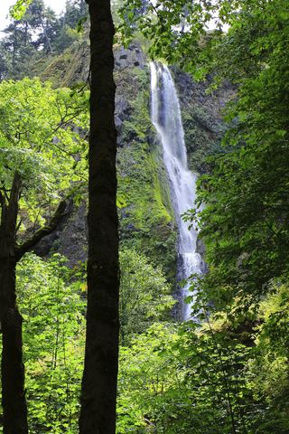
Lancaster Falls is a tall falls on Wonder Creek, but the trail passes only its lower tier, about 20 feet tall, which sprays almost onto the path. From the Starvation Creek Trailhead, walk west beside the freeway on the paved Historic Columbia River Highway State Trail past Cabin Creek Falls to the Mount Defiance Trail junction. Turn left onto the paved trail through a circular picnic area with a view of Hole in the Wall Falls, cross the footbridge below that falls, and climb about 140 feet to the powerline corridor junction with the Starvation Ridge Trail. Keep right to reach Wonder Creek and the lower tier. The tall upper tier is nearly invisible from the trail. Return the same way.
Plan your visit
Starvation Creek Trailhead, west on the Historic Columbia River Highway State Trail, then the Mount Defiance Trail to Wonder Creek
Oregon Hikers places Lancaster Falls 0.9 miles on foot from the Starvation Creek Trailhead. The Northwest Waterfall Survey says just under a mile.
Paved state trail, then natural-surface trail with a modest climb. Poison oak and nettles.
Where to start
Starvation Creek Trailhead at I-84 Exit 55, reachable only from the eastbound lanes; only 29 parking spaces.
Timing & water
Oregon Hikers lists the route as all year.
Before you go
Oregon Hikers lists a $10 day use fee at the Starvation Creek Trailhead.
Visitor informationVisit sources
More waterfalls nearby
Within 40 straight-line miles. Road and trail distances will differ.
- Lower Lancaster FallsState trail and Mount Defiance Trail to the lower tier20 ft (6 m) · Hood River County, OR0.0 miN
- Hole-in-the-Wall FallsPaved trail from Starvation Creek Trailhead to a picnic-circle view96 ft (29.2 m) · Hood River County, OR0.2 miNE
- Cabin Creek FallsShort paved walk from Starvation Creek Trailhead220 ft (67 m) · Hood River County, OR0.5 miE
- Harrison FallsHood River County, OR0.5 miW
- Lindsey Creek Falls53 ft (16.2 m) · Hood River County, OR0.7 miW
 Starvation Creek FallsShort paved walk to a viewpoint documented227 ft (69.2 m) · Hood River County, OR0.9 miE
- Summit Creek Falls30 ft (9.1 m) · Hood River County, OR1.1 miW
- Camp Benson FallsPartial guide: the last section uses a powerline maintenance road that is not confirmed as an official trail85 ft (25.9 m) · Hood River County, OR1.1 miW
- Dog Creek FallsRoute and parking documented; confirm current conditions.Skamania County, WA2.5 miNE