Norway Rapids
Grafton County, New Hampshire
Your visit at a glance
- Waterfall height
- Not recorded
- Location
- Grafton County, New Hampshire
- Access status
- Local trail network; distance not published
- The walk
- Distance not published
- Ground & access
- Easy. Good footing and little climbing. Brook crossings are difficult in high water.
Norway Rapids is a run of cascades and pools on a brook in Waterville Valley, reached by the short Norway Rapids Trail maintained by the Waterville Valley Athletic and Improvement Association (WVAIA). Start at the Snow's Mountain parking lot, in the north end away from the chairlift, and take the signed Cascade Path across Cascade Ridge Road. Follow it up through the development and an old ski trail, past the Elephant Rock Trail, down to a footbridge and the Lower Snow's Mountain cross-country ski trail. Walk up the ski trail to the Forest Service bridge over Cascade Brook, cross it, and follow the ski trail a short distance to the Norway Rapids Trail on the left. It wanders through hardwood forest with good footing and little climbing to the rapids. The trail continues across the brook to Livermore Road, but that crossing is usually difficult in high water.
Plan your visit
Snow's Mountain parking in Waterville Valley, Cascade Path to the Cascade Brook bridge and the Norway Rapids Trail
No distance to Norway Rapids is published. Waterville Valley Resort gives 3 miles out and back for the nearby Cascade Path to the Cascades, which passes the Norway Rapids Trail junction.
Easy. Good footing and little climbing. Brook crossings are difficult in high water.
Where to start
Snow's Mountain parking lot in Waterville Valley; park at the north end, farthest from the chairlift.
Timing & water
Brook crossings are difficult in high water.
Before you go
No fee is mentioned in the sources read.
Visitor informationVisit sources
More waterfalls nearby
Within 40 straight-line miles. Road and trail distances will differ.
- Fletcher CascadesNational forest trail into the Sandwich Range WildernessGrafton County, NH2.7 miS
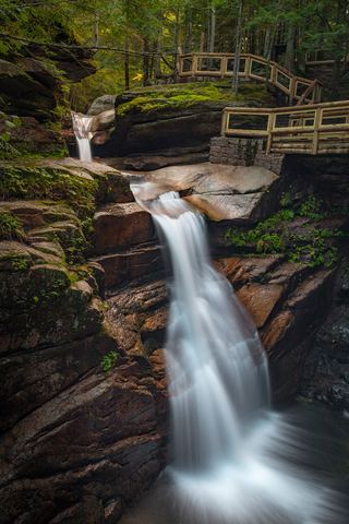 Sabbaday FallsSeasonal partial trail closureGrafton County, NH4.8 miE
- Great FallsMarked trail through permitted private land into the national forest15 ft (4.6 m) · Carroll County, NH5.2 miS
- Lower FallsCarroll County, NH5.3 miS
- Mill Brook CascadeGrafton County, NH7.4 miSW
- Beede FallsRoute and parking researchedCarroll County, NH9.8 miS
- Lower FallsPartial: town park trail; this listing is probably the lower Beede fallsCarroll County, NH9.8 miS
- Pitcher FallsRoute and parking researchedCarroll County, NH10 miE
- Champney FallsRoute and parking researchedCarroll County, NH10 miE