Fletcher Cascades
Grafton County, New Hampshire
Your visit at a glance
- Waterfall height
- Not recorded
- Location
- Grafton County, New Hampshire
- Access status
- National forest trail into the Sandwich Range Wilderness
- The walk
- About 3.2 miles return
- Ground & access
- Easy to moderate. Wet sections, a stream crossing, stone steps and a short steep climb. Steep, slippery rock at the cascade.
Fletchers Cascade is a series of chutes and ledges on Bowlder Brook in the Sandwich Range Wilderness, White Mountain National Forest. From the Sandwich Mountain and Drakes Brook parking lot, go left and around the gate. Follow the Drakes Brook cross-country ski trail for about 0.4 miles. Shortly after the Drakes Brook hiking trail splits right, turn onto the Fletchers Cascade Trail. It climbs gently along Bowlder Brook into the wilderness, crosses a stream, climbs a stone staircase and then goes steeply beside the brook. At a tall rock face the trail turns sharply left to the cascade. Do not climb across or above the cascade.
Plan your visit
Sandwich Mountain and Drakes Brook trailhead on NH 49, Drakes Brook ski trail and Fletchers Cascade Trail to Fletchers Cascade
Waterville Valley Resort and Trail Finder both give 3.2 miles for the out-and-back.
Easy to moderate. Wet sections, a stream crossing, stone steps and a short steep climb. Steep, slippery rock at the cascade.
Where to start
Sandwich Mountain and Drakes Brook parking lot on the east side of NH 49, 10.0 miles north of I-93 exit 28 and one mile south of Waterville Valley.
Timing & water
The cascade is seasonal and best in high water.
Before you go
No fee is listed by Trail Finder. The trailhead is not on the White Mountain National Forest list of fee sites.
Visitor informationMore waterfalls nearby
Within 40 straight-line miles. Road and trail distances will differ.
- Great FallsMarked trail through permitted private land into the national forest15 ft (4.6 m) · Carroll County, NH2.7 miSE
- Norway RapidsLocal trail network; distance not publishedGrafton County, NH2.7 miN
- Lower FallsCarroll County, NH2.8 miSE
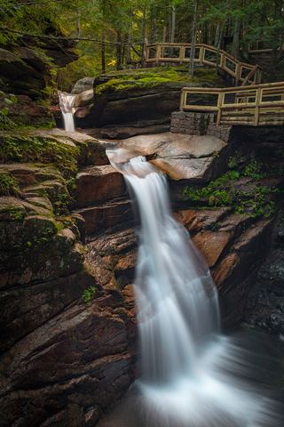 Sabbaday FallsSeasonal partial trail closureGrafton County, NH6.4 miNE
- Mill Brook CascadeGrafton County, NH6.7 miW
- Beede FallsRoute and parking researchedCarroll County, NH7.0 miS
- Lower FallsPartial: town park trail; this listing is probably the lower Beede fallsCarroll County, NH7.1 miS
- Champney FallsRoute and parking researchedCarroll County, NH11 miE
- Pitcher FallsRoute and parking researchedCarroll County, NH11 miE