Waterfalls near Mena, AR
14 named waterfalls within 30 miles of Mena, closest first. Distances are straight-line from the town center.
Visits with route details
Read the walking route, starting point and current access notes.
- Katy FallsSource-reviewed route and parking12 ft (3.7 m) · Polk County, AR
- Cossatot FallsResearched visit notes33 ft (10.1 m) · Howard County, AR
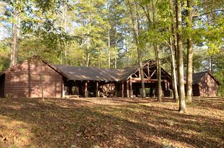 Shady Lake CascadeCurrent overlook access unconfirmed27 ft (8.2 m) · Polk County, AR
- Devils Hollow FallsRiver identity confirmed; walking approach unconfirmedHoward County, AR
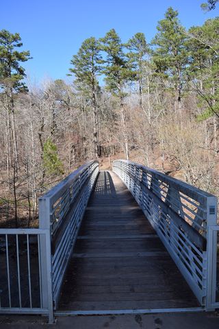 Little Missouri FallsOverlook route verified; parking connection from regional trail guideMontgomery County, AR
- Crooked Creek FallsPublished roadside parking and view; no developed walking route verified16 ft (4.9 m) · Montgomery County, AR
- Blaylock Creek FallsPull-off reported; walking approach unverified31 ft (9.5 m) · Montgomery County, AR
- Slate FallsPartial: off-trail route from older sources; exact parking and road condition unconfirmed54 ft (16.5 m) · Sebastian County, AR
- Panther Bluff FallsParking and current approach unconfirmed31 ft (9.5 m) · Howard County, AR
All 14 waterfalls
- Katy FallsSource-reviewed route and parking12 ft (3.7 m) · Polk County, AR16 miSE
- Trailhead Falls21 ft (6.4 m) · Polk County, AR18 miSE
- Cossatot FallsResearched visit notes33 ft (10.1 m) · Howard County, AR18 miS
- Shady Lake CascadeCurrent overlook access unconfirmed27 ft (8.2 m) · Polk County, AR20 miSE
- Devils Hollow FallsRiver identity confirmed; walking approach unconfirmedHoward County, AR20 miS
- Little Missouri FallsOverlook route verified; parking connection from regional trail guideMontgomery County, AR22 miSE
- Crooked Creek FallsPublished roadside parking and view; no developed walking route verified16 ft (4.9 m) · Montgomery County, AR23 miSE
- Blaylock Creek FallsPull-off reported; walking approach unverified31 ft (9.5 m) · Montgomery County, AR23 miSE
- Winding StaircaseMontgomery County, AR25 miSE
- Upper Whiskey FallsLe Flore County, OK25 miW
- Lower Whiskey FallsLe Flore County, OK25 miW
- Belle Star Cave Falls27 ft (8.2 m) · Sebastian County, AR27 miN
- Slate FallsPartial: off-trail route from older sources; exact parking and road condition unconfirmed54 ft (16.5 m) · Sebastian County, AR27 miN
- Panther Bluff FallsParking and current approach unconfirmed31 ft (9.5 m) · Howard County, AR28 miS