Waterfalls near Hickory, NC
29 named waterfalls within 30 miles of Hickory, closest first. Distances are straight-line from the town center.
Visits with route details
Read the walking route, starting point and current access notes.
- Granite FallsPartial guide: viewing platform exists but public access permission is unconfirmedCaldwell County, NC
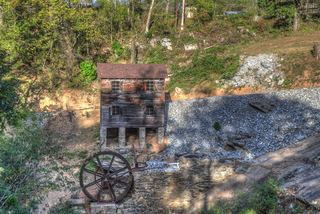 McGalliard FallsTown park with a short path; listed hours 8 AM to 8 PMBurke County, NC
- Little River FallsPartial guide: final approach is a steep bushwhack near a dangerous cliff topBurke County, NC
- Pot Branch FallsShort walk on old roads in South Mountains Game Land; rough gravel road with a fordRutherford County, NC
- Sally Queen FallsPartial: bushwhack with no trail; storm blowdowns reportedRutherford County, NC
- Moravian FallsPartial: private campground land; ask permission; current rules not confirmedWilkes County, NC
- Silvervale FallsRoadside view of a waterfall on private landCaldwell County, NC
- Ten Foot FallsRoadside view in the reopened Wilson Creek Gorge day use areaCaldwell County, NC
- Phillips Branch FallsForest trail and steep scramble path; Wilson Creek day use area reopened 202643 ft (13 m) · Caldwell County, NC
- Thorps Creek FallsNational forest trail from a campgroundCaldwell County, NC
All 29 waterfalls
- Granite FallsPartial guide: viewing platform exists but public access permission is unconfirmedCaldwell County, NC6.1 miNW
- McGalliard FallsTown park with a short path; listed hours 8 AM to 8 PMBurke County, NC13 miW
- Little River FallsPartial guide: final approach is a steep bushwhack near a dangerous cliff topBurke County, NC18 miSW
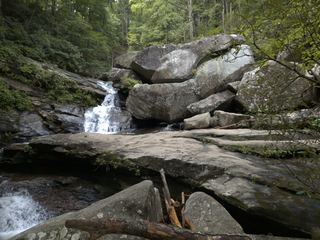 Big Bear FallsBurke County, NC19 miSW
- High Shoals FallsBurke County, NC19 miSW
- Upper High Shoals FallsBurke County, NC19 miSW
- Beautimos FallsCleveland County, NC22 miSW
- Adako FallsCaldwell County, NC23 miNW
- Black Mountain FallsRutherford County, NC23 miSW
- Pot Branch FallsShort walk on old roads in South Mountains Game Land; rough gravel road with a fordRutherford County, NC24 miSW
- High ShoalsGaston County, NC25 miS
- Upper Shoal Creek FallsBurke County, NC25 miW
- Shoal Creek FallsBurke County, NC25 miW
- Sally Queen FallsPartial: bushwhack with no trail; storm blowdowns reportedRutherford County, NC25 miSW
- RazorbackCaldwell County, NC26 miNW
- Triple DropCaldwell County, NC26 miNW
- Moravian FallsPartial: private campground land; ask permission; current rules not confirmedWilkes County, NC26 miN
- Thunder HoleCaldwell County, NC26 miNW
- Boat BusterCaldwell County, NC26 miNW
- Silvervale FallsRoadside view of a waterfall on private landCaldwell County, NC26 miNW
- 4x4 FallsBurke County, NC26 miNW
- Ten Foot FallsRoadside view in the reopened Wilson Creek Gorge day use areaCaldwell County, NC26 miNW
- Resurrection FallsRutherford County, NC28 miSW
- Little Long Creek FallsGaston County, NC28 miS
- Destiny FallsCaldwell County, NC29 miNW
- Phillips Branch FallsForest trail and steep scramble path; Wilson Creek day use area reopened 202643 ft (13 m) · Caldwell County, NC29 miNW
- Somey Creek FallsRutherford County, NC29 miSW
- Dugger Creek FallsWilkes County, NC29 miN
- Thorps Creek FallsNational forest trail from a campgroundCaldwell County, NC30 miNW