Pipestone Falls
Lake County, Minnesota
Your visit at a glance
- Waterfall height
- Not recorded
- Location
- Lake County, Minnesota
- Access status
- Canoe route documented; parking and permit details unverified
- The walk
- Canoe trip with two portages; the Pipestone Falls portage is 90 rods (about 0.3 mile) one-way
- Ground & access
- Lake paddling and two portage trails described as smooth. Motorboats share these lakes.
Pipestone Falls is reached by canoe. From the Fall Lake entry point, paddle north and portage around Newton Falls into Newton Lake. Paddle about two miles to the north end of Newton Lake, where a 90-rod portage runs beside Pipestone Falls into Pipestone Bay of Basswood Lake. Return the same way.
Plan your visit
Canoe from Fall Lake (BWCA Entry Point 24) through Newton Lake to the Pipestone Falls portage
Portage lengths are in rods (1 rod = 16.5 feet). BWCAwild gives 40 rods around Newton Falls; Friends of the Boundary Waters gives 80 rods. Both give 90 rods for the Pipestone Falls portage. Newton Lake is about two miles of paddling. No total trip distance is assigned.
Lake paddling and two portage trails described as smooth. Motorboats share these lakes.
Where to start
Fall Lake is the location of BWCA Entry Point 24 and the Forest Service Fall Lake Campground near Ely. The exact entry point parking area and any parking fee were not checked.
Timing & water
Open-water paddling season only. Current conditions unverified.
Before you go
A Boundary Waters permit is required for Entry Point 24. Permit type, quota and fees for a day trip were not verified.
Visitor informationMore waterfalls nearby
Within 40 straight-line miles. Road and trail distances will differ.
- Newton FallsLake County, MN2.2 miS
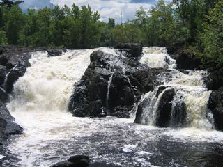 Kawishiwi FallsShort trail from a free lot; rocks and rootsLake County, MN4.9 miS
- Dry FallsForest Service trail and published out-and-back distanceSt. Louis County, MN6.9 miSW
- Lower Basswood FallsLake County, MN7.8 miN
- Sioux FallsCanoe route documented; restricted BWCA permit quotaSt. Louis County, MN23 miW
- Devils CascadePartial guide: exact hiking trailhead parking is unconfirmedSt. Louis County, MN28 miNW
- Eddy FallsLake County, MN29 miE
- Loon FallsSt. Louis County, MN32 miNW