Bridal Veil Falls
Cook County, Minnesota
Your visit at a glance
- Waterfall height
- Not recorded
- Location
- Cook County, Minnesota
- Access status
- Published hiking route and trailhead documented
- The walk
- About 7 miles return, added up from published segment distances
- Ground & access
- Old road grade at first, then single-track with rocks, roots and elevation changes. The spur is a steep descent of about 100 feet.
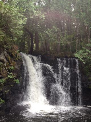
From the Crab Lake Trail trailhead on North Loon Lake Road, follow the Crab Lake Trail to the Y junction and bear left on the Crab Lake Cut-Off. At the Border Route Trail turn left (west) and walk about 1 mile to the signed Bridal Falls spur on the right, shortly after a creek crossing. The spur drops about 100 feet to the base. Return the same way. A boat approach from Gunflint Lake also exists.
Plan your visit
Crab Lake Trail, Crab Lake Cut-Off and Border Route Trail to the Bridal Falls spur
Added up from bwcawild.com segment figures: about 1.72 miles on the Crab Lake Trail, 0.65 mile on the Cut-Off, about 1 mile west on the Border Route Trail and a 0.2-mile spur, then doubled. Clearwater Lodge gives 6+ miles round trip.
Old road grade at first, then single-track with rocks, roots and elevation changes. The spur is a steep descent of about 100 feet.
Where to start
Crab Lake Trail trailhead, 0.8 mile along North Loon Lake Road (County Road 51), off the Gunflint Trail about 39 miles from Grand Marais. The source says it holds at least eight cars. The road is narrow gravel with sharp turns.
Timing & water
Most water during spring runoff. Winter access on the gravel road is unverified.
Before you go
The route briefly enters the Boundary Waters Canoe Area Wilderness; the source says a BWCA permit is technically needed. It reported not finding a permit box on its last visit. Check permit rules with Superior National Forest.
Visitor informationVisit sources
More waterfalls nearby
Within 40 straight-line miles. Road and trail distances will differ.
- Rib Lake Falls7 ft (2 m) · Cook County, MN7.8 miSW
- Rose FallsDocumented wilderness trail; free day permit; distance figures differCook County, MN8.8 miE
- Saganaga FallsCanoe-only wilderness route; permit details not confirmedCook County, MN13 miNW
 Johnson FallsCanoe-access trail documented; entry point parking and permit details unverifiedCook County, MN17 miE
- Eddy FallsLake County, MN22 miW
- Hidden FallsCook County, MN25 miS
- Barrier Falls20 ft (6 m) · Cook County, MN27 miSE
- Fall River WaterfallPartial guide: parking permission and land status of the short path are unconfirmedCook County, MN27 miSE
- The CascadesState park loop trail with published distanceCook County, MN27 miS