Saganaga Falls
Cook County, Minnesota
Your visit at a glance
- Waterfall height
- Not recorded
- Location
- Cook County, Minnesota
- Access status
- Canoe-only wilderness route; permit details not confirmed
- The walk
- Multi-day canoe trip; the full route is 22 miles over about 3 days
- Ground & access
- Wilderness lakes and river with 11 portages, the longest 115 rods. Low water late in summer and fall can change the route.
Saganaga Falls is where the Granite River meets Saganaga Lake on the Canada border in the Boundary Waters Canoe Area Wilderness. It is reached only by canoe. One published route starts on Gunflint Lake (entry point 57), paddles through Magnetic Lake and down the Granite River, and portages around Saganaga Falls before Saganaga Lake. Arrange a shuttle back to your car. Boundary Waters permit rules and fees were not confirmed from an official source; check with the Superior National Forest before going.
Plan your visit
Boundary Waters canoe route: Gunflint Lake (entry point 57) through Magnetic Lake and down the Granite River to the portage around Saganaga Falls
Friends of the Boundary Waters lists the Granite River route to Saganaga as 22 miles, 3 days and 11 portages. The distance to the falls alone is not given. This is a paddling distance, not a walk.
Wilderness lakes and river with 11 portages, the longest 115 rods. Low water late in summer and fall can change the route.
Where to start
Start at entry point 57 on Gunflint Lake off the Gunflint Trail. Exact launch parking was not confirmed.
Timing & water
Open-water season only. Low water late in summer and fall can drastically change the route.
Before you go
Boundary Waters permit rules, fees and reservations were not confirmed from an official source.
Visitor informationVisit sources
More waterfalls nearby
Within 40 straight-line miles. Road and trail distances will differ.
- Rib Lake Falls7 ft (2 m) · Cook County, MN13 miS
- Bridal Veil FallsPublished hiking route and trailhead documentedCook County, MN13 miSE
- Eddy FallsLake County, MN16 miSW
- Rose FallsDocumented wilderness trail; free day permit; distance figures differCook County, MN21 miSE
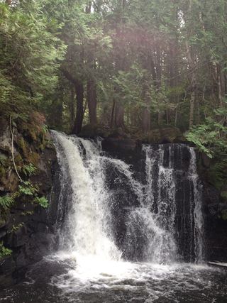 Johnson FallsCanoe-access trail documented; entry point parking and permit details unverifiedCook County, MN29 miSE
- Hidden FallsCook County, MN36 miSE
- The CascadesState park loop trail with published distanceCook County, MN39 miS
- Cascade FallsOfficial park loop documentedCook County, MN39 miS
- Poplar River FallsResort and county tourism route to the trail bridge above the fallsCook County, MN39 miS