Mesa Falls
Fremont County, Idaho
Your visit at a glance
- Waterfall height
- 115 ft (35 m)
- Location
- Fremont County, Idaho
- Access status
- Construction closure; reopening unconfirmed
- The walk
- Do not enter closed recreation areas
- Ground & access
- Trail surfaces disrupted by construction; closed to visitors.
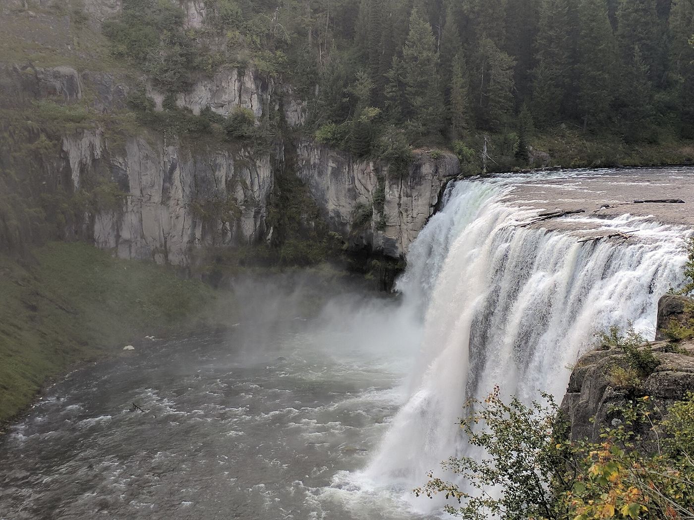
The Forest Service confirms temporary closure of both Upper and Lower Mesa Falls during construction. Trail paving has disrupted surfaces, and entering restricted areas on foot is also prohibited. No subsequent reopening was established in this review.
Plan your visit
Closed during construction
Only the stated source distance is supported; mapped proximity is not a walking distance.
Trail surfaces disrupted by construction; closed to visitors.
Where to start
Do not pass barricades or use the closed lots. A future visit requires confirmation that the Forest Service has reopened the site.
Timing & water
September 16, 2026 Forest Service notice aims for spring reopening but does not confirm a reopening date.
Before you go
No visit offered while the recreation areas are closed.
Visitor informationVisit sources
More waterfalls nearby
Within 40 straight-line miles. Road and trail distances will differ.
 Lower Mesa FallsClosed for construction under the September 16, 2026 USFS notice; no open approach verified.Fremont County, ID1.0 miSE
- Dunanda FallsLong Yellowstone backcountry day hike from the Bechler Ranger Station; stream crossings that may need wadingTeton County, WY16 miE
- Silver Scarf FallsLong national park day hike with fords; falls a short walk from the Dunanda Falls junctionTeton County, WY16 miE
 Bechler FallsOctober 27, 2026: regional snow and ice reported; Cave Falls Road condition unverified15 ft (4.6 m) · Teton County, WY16 miE
- Cave FallsSource-reviewed route and parkingTeton County, WY17 miE
- Ouzel FallsPartial guide: distant view from a long meadow trail; no trail to the falls and the distance to the viewing point is not statedTeton County, WY18 miE
- Lower Colonnade FallsPartial guide: long backcountry trail with deep fords; distance from the trailhead not stated66 ft (20 m) · Teton County, WY19 miE
- Upper Colonnade FallsPartial guide: long backcountry trail with deep fords; distance from the trailhead not stated36 ft (11 m) · Teton County, WY19 miE
 Iris FallsSnow and ice reported; historical route and parking gap45 ft (13.7 m) · Teton County, WY19 miE