Griers Falls
Polk County, Wisconsin
Your visit at a glance
- Waterfall height
- Not recorded
- Location
- Polk County, Wisconsin
- Ground elevation
- About 772 ft above sea level
- Land
- Gristmill Park
- Nearby mapped access
- Unnamed parking area
A nearby mapped parking area or trailhead may not connect to this waterfall. Confirm the route and public access before travelling.
Griers Falls is mapped in Polk County, Wisconsin, 0.1 miles southwest of Osceola. This entry shows its location and nearby mapped places; a visitor route has not been confirmed.
About this location
Land & access
The land ownership record at this location lists Gristmill Park. The listed manager is city. The land record lists public access. Check the manager’s current visitor information for permitted routes and closures.
Nearby named trails
- Cascade Falls Trail
These paths are mapped within 250 metres (about 820 feet) of the waterfall. A connection to a viewpoint has not been verified.
Sources for these details
Nearby streams and paths: OpenStreetMap. Land names: USGS PAD-US ownership records, with planning boundaries used only where ownership has no usable name. Ground elevation: USGS 3D Elevation Program.
Map records do not verify a walking route or current access conditions.
Before you make the trip
The closest mapped parking is 0.1 mi away in a straight line. This is not a walking distance.
Trail length, parking rules and current conditions have not been confirmed for this entry.
More waterfalls nearby
Within 40 straight-line miles. Road and trail distances will differ.
- Cascade FallsVillage stairway from the main street to the fallsPolk County, WI0.0 miNW
- Buttermilk FallsPartial guide: short conservancy trail to an unsigned spur; views need a narrow rock fin or a steep slopePolk County, WI2.4 miSW
- Silverbrook FallsState park trail to a falls with an observation point16 ft (5 m) · Polk County, WI4.2 miNE
- Fairy FallsUnmaintained trail in an NPS day use area; reopening depends on parkingWashington County, MN17 miS
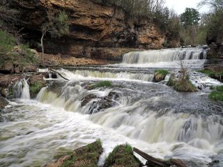 Willow FallsState park trail from the Willow Falls parking lotSt. Croix County, WI21 miS
- Phalen Regional Park WaterfallLakeside trail location known; parking and pump schedule not confirmedRamsey County, MN28 miSW
- Hamm’s Memorial WaterfallsCity park feature; exact parking and path not confirmedRamsey County, MN32 miSW
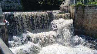 Shingle Creek FallsPark path directions; parking and distance not confirmedHennepin County, MN35 miSW
- Bridal Veil FallsCity viewpoint; staircase location and walking distance not confirmedHennepin County, MN35 miSW