Buttermilk Falls
Polk County, Wisconsin
Your visit at a glance
- Waterfall height
- Not recorded
- Location
- Polk County, Wisconsin
- Access status
- Partial guide: short conservancy trail to an unsigned spur; views need a narrow rock fin or a steep slope
- The walk
- 0.4 mile on the Buffalo Skull Loop Trail to the unsigned spur junction (Hiking Project); the spur length is not stated
- Ground & access
- Gentle grassland and forest trail to the spur. At the falls, a narrow rock fin and a steep, rooty slope; both are dangerous when wet, snowy or icy.
Buttermilk Falls is a 40-foot cascade where a spring-fed stream tumbles over many small ledges on its way to the St. Croix River, south of Osceola. The approach is on the Buffalo Skull property of the Standing Cedars Community Land Conservancy, which is open to the public for hiking; the property borders National Park Service land of the St. Croix National Scenic Riverway. From the kiosk on 55th Avenue, walk the Buffalo Skull Loop Trail through open grassland for 0.4 mile to an unsigned junction and take the spur trail to the falls. A view from above means walking out along a rock fin with one narrow spot; a view from below means descending a moderately steep slope beside the falls. Do not walk on the railroad tracks near the falls. Return the same way.
Plan your visit
Standing Cedars kiosk and parking lot on 55th Avenue (Draw Bridge Drive), the Buffalo Skull Loop Trail to an unsigned junction, then the spur trail to the falls
Hiking Project gives 0.4 mile from the kiosk on the Buffalo Skull Loop Trail to the unsigned junction with the spur to the falls. The length of the spur is not stated.
Gentle grassland and forest trail to the spur. At the falls, a narrow rock fin and a steep, rooty slope; both are dangerous when wet, snowy or icy.
Where to start
Parking lot with a signboard and property map at the Standing Cedars kiosk on 55th Avenue (Draw Bridge Drive). The dirt road in can be potholed and flooded.
Timing & water
The descent below the falls is easiest and safest in summer when dry. Standing Cedars advises against hiking during Wisconsin deer gun seasons and advises blaze orange in other hunting seasons. Dogs must be leashed April 15 to July 31.
Before you go
No fee is mentioned. Standing Cedars land is open sunrise to sunset.
Visitor informationVisit sources
- Hiking Project: Buttermilk Falls
- Hiking Project: Buttermilk Falls
- Hiking Project: Buttermilk Falls
- Hiking Project: Buttermilk Falls
- Hiking Project: Buttermilk Falls
- Hiking Project: Buttermilk Falls
- AdamMartin.SPACE: Buttermilk Falls
- AdamMartin.SPACE: Buttermilk Falls
- AdamMartin.SPACE: Buttermilk Falls
- Standing Cedars: Frequently asked questions
- Standing Cedars: Frequently asked questions
- Standing Cedars: Frequently asked questions
- Standing Cedars: Frequently asked questions
- Standing Cedars: Buffalo Skull
More waterfalls nearby
Within 40 straight-line miles. Road and trail distances will differ.
- Cascade FallsVillage stairway from the main street to the fallsPolk County, WI2.4 miNE
- Griers FallsPolk County, WI2.4 miNE
- Silverbrook FallsState park trail to a falls with an observation point16 ft (5 m) · Polk County, WI6.5 miNE
- Fairy FallsUnmaintained trail in an NPS day use area; reopening depends on parkingWashington County, MN15 miS
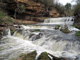 Willow FallsState park trail from the Willow Falls parking lotSt. Croix County, WI19 miS
- Phalen Regional Park WaterfallLakeside trail location known; parking and pump schedule not confirmedRamsey County, MN26 miSW
- Hamm’s Memorial WaterfallsCity park feature; exact parking and path not confirmedRamsey County, MN29 miSW
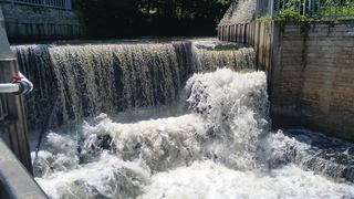 Shingle Creek FallsPark path directions; parking and distance not confirmedHennepin County, MN32 miSW
- Bridal Veil FallsCity viewpoint; staircase location and walking distance not confirmedHennepin County, MN33 miSW