Mille Creek Falls (Left Hand)
Grand County, Utah
Your visit at a glance
- Waterfall height
- Not recorded
- Location
- Grand County, Utah
- Access status
- Guide: Mill Creek trail into the North Fork
- The walk
- About 0.8 mile one way, per a BLM Moab hiking trails brochure
- Ground & access
- Mostly flat, sandy trail with three shallow but cold creek crossings. Expect wet feet.
This listing is the waterfall on the left-hand (North) fork of Mill Creek, just east of Moab, on BLM land. The canyon mouth is reached by Powerhouse Lane from the parking area next to the remains of an old dam. Follow the trail upstream beside Mill Creek, past the man-made falls at the old mill site. About halfway, the creek forks: take the left path, cross the creek, and enter the steep-sided North Fork canyon. There are three short creek crossings in all; after the third, take the right-hand path beside the creek to the base of the falls. The path that climbs left after the third crossing scrambles to the top of the falls and is steep. Return the same way.
Plan your visit
Mill Creek trailhead at the end of Powerhouse Lane in Moab, upstream along Mill Creek to the fork, then left into the North Fork with three shallow creek crossings to the falls
A BLM Moab hiking trails brochure gives 0.8 mile to the first waterfall on the North Fork. The man-made falls at the old dam, a quarter mile from the lot, is a different, smaller drop.
Mostly flat, sandy trail with three shallow but cold creek crossings. Expect wet feet.
Where to start
Public lot at the end of Powerhouse Lane, Moab, with a pit toilet. Do not park where prohibited along Powerhouse Lane or on private property; the lot can be full.
Timing & water
Mill Creek flows year round. Crossings are colder and deeper at high water; avoid the canyon in flash-flood weather.
Before you go
No fee or permit is required, per a hiking site. No booking is needed.
Visitor informationVisit sources
- BLM: Mill Creek Canyon Wilderness Study Area
- BLM: Mill Creek Canyon Wilderness Study Area
- BLM: Moab area hiking trails brochure
- BLM: Moab area hiking trails brochure
- 10Adventures: Mill Creek
- 10Adventures: Mill Creek
- 10Adventures: Mill Creek
- 10Adventures: Mill Creek
- Hikespeak: Mill Creek, Moab
- Hikespeak: Mill Creek, Moab
More waterfalls nearby
Within 40 straight-line miles. Road and trail distances will differ.
- Medieval ChamberGrand County, UT2.0 miN
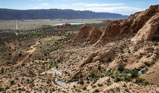 Faux FallsShort trail from a signed trailhead documented; rough dirt spur roadSan Juan County, UT7.6 miSE
- "Slytherin Falls"Partial guide: likely the Mary Jane Canyon falls; name not confirmedGrand County, UT12 miNE
- Indian Creek FallPartial guide: roadside falls; parking spot not statedSan Juan County, UT26 miS
- Lower JumpSan Juan County, UT30 miSW