Glen Falls 15
Hamilton County, Tennessee
Your visit at a glance
- Waterfall height
- Not recorded
- Location
- Hamilton County, Tennessee
- Access status
- Guide: short park trail; falls are seasonal
- The walk
- 1.2 miles round trip
- Ground & access
- Moderately strenuous, up and down hills. Rock formations, boulder fields and stone stairs near the falls. The south end of the trail is described as overgrown.
Glen Falls is a seasonal waterfall on the east side of Lookout Mountain, on the Glen Falls Trail in the Lookout Mountain Battlefield unit of Chickamauga and Chattanooga National Military Park. Start at the trailhead on Ochs Highway across from the Shingle Trail. The trail is mainly downhill to the falls with no confusing side trails, and it has a footbridge and stone steps near the falls. Water flows only in wet periods. Return the same way on the trail. Do not walk back along Ochs Highway: a visitor guide warns that traffic is fast and there is no shoulder.
Plan your visit
Glen Falls Trail from its north trailhead on Ochs Highway, across from the Shingle Trail, to the falls and back
National Park Planner gives 1.2 miles round trip to the falls and back from the north entrance. The National Park Service says the whole trail runs about 3/4 mile along the mountainside.
Moderately strenuous, up and down hills. Rock formations, boulder fields and stone stairs near the falls. The south end of the trail is described as overgrown.
Where to start
Small roadside pullout lot on Ochs Highway. Coming up the mountain from Chattanooga, it is the first pullout after Sanders Road, on the opposite side of the road, per a visitor guide.
Timing & water
The falls flow only during wet times, such as after rain or in spring.
Before you go
No fee is mentioned. No booking is needed.
Visitor informationVisit sources
More waterfalls nearby
Within 40 straight-line miles. Road and trail distances will differ.
- Lower Cascades Glen Falls 65Hamilton County, TN0.0 miE
- Upper Glen Falls 12Hamilton County, TN0.1 miNW
- High FallsPartial guide: inside a paid attraction; falls coordinates not confirmed by Rock City100 ft (30.5 m) · Walker County, GA1.0 miS
- Lula Falls 100Official route documented; reservation and fee required; limited open daysWalker County, GA4.1 miSW
- Lula Lake Falls 30Partial guide: exact feature at Lula Lake unconfirmed; reservation days onlyWalker County, GA4.3 miSW
- Blowing Wind FallsRitchie Hollow Trail from the river or from the plateauMarion County, TN8.4 miNW
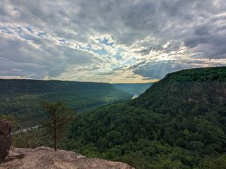 Julia Falls 95Overlook view from the Cumberland Trail; wet-weather fallsHamilton County, TN9.6 miN
 Rainbow Falls 40Partial guide: final descent is an unmaintained steep path; height differs between sourcesHamilton County, TN9.7 miN
- Hemlock FallsResearched visit notes89 ft (27 m) · Dade County, GA13 miSW