WaterfallNear Me

Kentucky waterfall visits

Compare 25 Kentucky waterfall visits by the approach, terrain, and where to start. Some routes have closures or unresolved details; read the individual guide before travelling.

25 visit options

Cumberland Falls, KY

Paved short walk from visitors center to overlooks; some platforms may close

Kentucky

Cumberland Falls

About 0.54 mile return on paved path

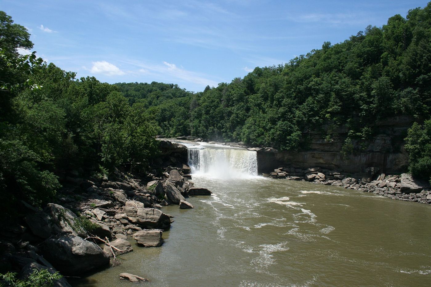
Cumberland Falls on the Cumberland River is the centerpiece of Cumberland Falls State Resort Park. From the visitors center lot on KY 90, walk past the gift shop and restrooms along the river to the first viewing platform at the top of the falls, then continue and go down steps to further platforms. Some platforms close in winter or for safety work.
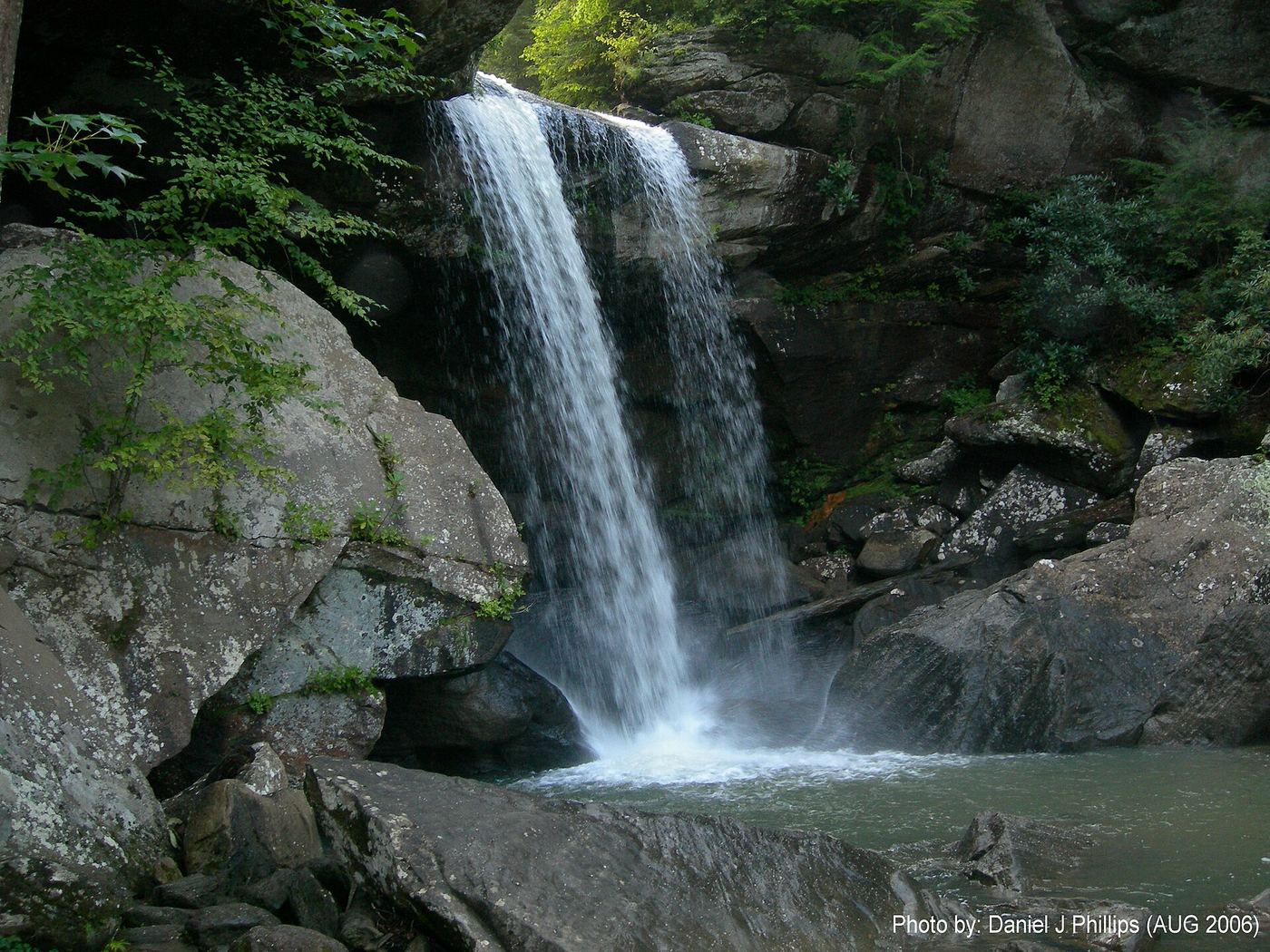
Photo creditPhoto: ChrisKuehl, Public domain, via Wikimedia Commons
Eagle Creek Falls, KY

Marked state park trail with published GPS; closes in high water

Kentucky

Eagle Creek Falls

About 2.1 miles for the lollipop loop that includes the falls

This is Eagle Falls on Eagle Creek in Cumberland Falls State Resort Park. Kentucky Hiker says the trailhead is at the northwest corner of the parking area on westbound KY-90. Follow Trail 9 to the loop and turn left (west) to Eagle Creek Cascades, then take the spur down stone and metal stairs and turn downstream to Eagle Falls. Finish the loop back to the trailhead.

Photo creditPhoto: Kysailor at English Wikipedia, CC BY-SA 3.0, via Wikimedia Commons

Short Sheltowee Trace walk described; parking and distance not confirmed

Kentucky

Alcorn Branch Falls

Short walk; distance not published

Start at Arvel near the old Arvel post office, where Todd Grocery sits at the trailhead. Follow the Sheltowee Trace along an old dirt road, then a foot trail that descends from oak woods into a moist valley where the Trace looks out on Alcorn Branch Falls. Return the same way.

Location map; no photo available.

Official preserve trail and parking

Kentucky

Anglin Falls

One-mile foot trail (state figure; one way or return not stated)

The preserve is owned by Berea College and managed with the Office of Kentucky Nature Preserves. It protects a wooded gorge and the 75-foot wet-weather Anglin Falls. Drive Anglin Falls Road to the sign beside mailbox 542 R2, turn left and go 0.2 mile to the parking area and trailhead. The marked trail climbs the gorge to the falls. Stay on the marked trail. Return the same way.

Location map; no photo available.

Partial guide: which small falls this is has not been confirmed

Kentucky

Bark Camp Branch Falls

Part of a 5.3-mile out-and-back to the Bark Camp Creek cascades

Bark Camp Trail #413 starts on Forest Road 193 and follows the north bank of Bark Camp Creek to the Sheltowee Trace near the Cumberland River. Kentucky Hiker reports at least three wet-weather waterfalls on the cliffline to the right before the Sheltowee Trace footbridge, and the main cascades beyond. This appears to be one of the smaller falls along the way, not the main cascades.

Location map; no photo available.

Published route with matching coordinates

Kentucky

Bark Camp Creek Cascades

5.3 miles return

From the roadside trailhead, follow the marked trail on the north side of Bark Camp Creek, keeping the creek on your left and rock walls on your right. Pass at least three wet-weather falls before the Sheltowee Trace footbridge. Continue straight past a campsite, then turn left and descend steeply to the cascades viewing area. Return the same way.

Location map; no photo available.

Short unmarked path from a roadside pull-off; exact GPS published

Kentucky

Bell Falls

About 0.2 mile total for the forked out-and-back to both falls

Park at the unmarked pull-off on the north side of KY-715; the lower falls are visible from the road. Kentucky Hiker says to follow the trail down toward Bell Falls and cross Bell Branch to the rock overhang behind the falls. An uphill trail near the road leads to Upper Bell Falls. Retrace your steps. The author asks hikers to use this forked route to limit erosion.

Location map; no photo available.

Signed trail and spur to viewing deck from Blue Heron

Kentucky

Big Spring Falls

About 7.8 miles return

Big Spring Falls is in Big South Fork National River and Recreation Area, McCreary County. From the concession and restroom building at Blue Heron, walk the paved path north to the bridge over the Big South Fork, cross, and turn left (south) on the Kentucky Trail. Pass the Catawba Overlook spur (mile 1.8) and Dick Gap Falls spur (mile 2.5). At mile 3.7 take the spur marked WATERFALL .3 MI to the viewing deck.

Location map; no photo available.

Partial guide: current condition of park stairs and trails not confirmed

Kentucky

Broke Leg Falls

Short stair descent; length not measured

Broke Leg Falls, about 80 feet, has been a roadside stop on US 460 in eastern Menifee County since the 1940s. Menifee County bought the site as a park and added parking, picnic shelters and trails. Rock stairways lead down into the box canyon below a large overhang; after a 2012 tornado the falls also became visible from the road, and the bridge and stairs were later repaired.

Location map; no photo available.

Partial guide: unmarked wilderness path and informal roadside pull-offs

Kentucky

Copperas Falls

Distance to the falls alone not published; about 3.5 miles return including a side trip to Sandy Arch

Copperas Falls is in the Clifty Wilderness, Daniel Boone National Forest. A Kentucky Hiker Project visitor account follows an unmarked, unmaintained but easily navigated path up Copperas Creek from the KY-715 trailhead, keeping east of the drainage and zig-zagging across the creek for much of the final three-quarters of a mile. Near the falls, pass between a pair of boulders with cut trees. Return the same way.

Location map; no photo available.

Kentucky

Creation Falls

Short loop; distance not stated

Follow the Rock Bridge loop past Creation Falls and Rock Bridge Arch.

Location map; no photo available.

Official open access from lower trailhead; creek ford required

Kentucky

Dog Slaughter Falls

Distance from the lower trailhead not published by the Forest Service

Dog Slaughter Falls is a 15-foot waterfall on Dog Slaughter Creek in the London Ranger District, Daniel Boone National Forest. Storm damage has closed Trail #414 between its two trailheads, but the Forest Service says the lower trailhead and parking area closest to the falls is open and passable to the falls. The bridge there was removed, so you must cross the creek.

Location map; no photo available.

Guided hikes only; no self-guided access

Kentucky

Elk Lick Falls

Set by the guided program; not published in reviewed pages

Elk Lick Falls can be visited only on a guided hike or program run by Floracliff Nature Sanctuary in Lexington. Register through the Floracliff events page. Self-guided visits are not allowed and pets are not permitted.

Location map; no photo available.

Permit-only Metro park trail; parking location given with permit

Kentucky

Fairmont Falls

Half-mile trail

Fairmount Falls is in Jefferson Memorial Forest, a Louisville Metro park. A hiking permit is required; it is free from the Jefferson Memorial Forest Welcome Center at 502-368-5404. The short woodland trail from the parking area gives views of the waterfall when water is flowing, and the trail crosses the top of the falls. A short in-and-out trail continues beyond the falls.

Location map; no photo available.

County park with paved overlook path; lower trail crosses creek

Kentucky

Flat Lick Falls

About 0.25 mile to the upper overlook; about 0.6 mile total including the lower view

Flat Lick Falls is in a Jackson County park at Gray Hawk. From the parking lot near the large covered picnic area, a paved, wheelchair-accessible path leads about a quarter mile to a bench at the top overlook. A dirt trail to the right of the bench descends, crosses Flat Lick Creek and reaches the base of the falls.

Location map; no photo available.

Partial trail closure: access to Fulling Mill is unconfirmed; do not assume the full loop is open.

Kentucky

Fulling Mill Falls

Published full loop: 6 miles; currently usable waterfall route unknown

Shaker Village identifies Fulling Mill as a waterfall stop on Shawnee Run Trail, but does not locate the closed segment on the reviewed page.

Location map; no photo available.

Researched route and starting area

Kentucky

Lick Creek Falls

Waterfall-specific distance unknown.

The official trailhead connects the parking area to the named main trail and falls spur.

Location map; no photo available.

Partial guide: drive-by view only; no safe place to stop confirmed

Kentucky

Lower Lily Creek Falls

Roadside view from the highway; no walk described

The Lake Cumberland Vacation Guide lists Big Lily Creek Waterfall beside Highway 619 in Russell County at this location and gives 5570 East Highway 619, Jamestown, as the closest address. It is seen from the road while driving. The guide warns there is no shoulder to pull off on. The guide uses the name Big Lily Creek Waterfall.

Location map; no photo available.

Short unmarked trail from county park; rope-assisted descent

Kentucky

McCammon Falls

About 0.3 mile total (forked out and back)

McCammon Branch Falls is just behind Gray Hawk Community Park in Jackson County. Drive to the end of the park drive and park to the right of the restrooms. The unmarked trailhead is near the far corner of the mowed grass by the picnic shelter. A very short trail reaches the top of the falls; a user-fixed rope assists the descent to the base.

Location map; no photo available.

Marked trail route and designated parking documented

Kentucky

Pooch's Turtle Falls

Distance to the falls not published; return the same way

From the Rock Bridge South Trailhead, walk downhill past Creation Falls and Rock Bridge, then go straight through the junction onto Swift Camp Creek Trail. Continue until the trail crosses a small stream at the top of Pooch's Turtle Falls. A better view of the falls needs a scramble down to the creek. Return the same way on the marked trails.

Location map; no photo available.

Partial guide: trail and distance to Silver Falls not confirmed

Kentucky

Silver Falls

Distance to Silver Falls not confirmed

This waterfall lies inside Raven Run Nature Sanctuary, a Lexington-Fayette Urban County Government park and state nature preserve off Jacks Creek Pike. Visitors must stay on the marked trails. The specific trail to Silver Falls was not confirmed in the reviewed sources.

Location map; no photo available.

Partial guide: exact trailhead and parking not confirmed

Kentucky

Town Creek Falls

About 1 mile return

Islands.com describes Town Creek Falls in Monticello as the easiest local waterfall to reach. The walk begins near Kennett's Antiques downtown and follows a short, gently sloped trail to pools and layered rock. The exact trailhead and parking were not described.

Location map; no photo available.

Published short loop with matching coordinates

Kentucky

Turkey Foot Loop Trail Falls

0.9-mile loop

From the Turkey Foot day use parking, walk south to the upper campground loop and take the trail just left of campsite 15. Climb switchbacks to the Turkey Foot Loop Trail and turn right (south); the top of the cascade is 0.15 miles further. A user path about 50 to 60 yards back drops to the base of the cascade.

Location map; no photo available.

Short unmarked path from a roadside pull-off; exact GPS published

Kentucky

Upper Bell Falls

About 0.2 mile total for the forked out-and-back to both falls

Upper Bell Falls is just above Bell Falls on Bell Branch. Park at the unmarked pull-off on the north side of KY-715; the lower falls are visible from the road. Kentucky Hiker says to follow the trail down toward Bell Falls and cross Bell Branch to the rock overhang behind the falls. Return almost to the road, then take the trail uphill to Upper Bell Falls. Retrace your steps. The author asks hikers to use this forked route to limit erosion.

Location map; no photo available.

Official loop and parking documented

Kentucky

Yahoo Falls

1-mile loop

Yahoo Falls drops 113 feet and is Kentucky's highest waterfall, per the National Park Service. From the north end of the parking area, take the Yahoo Falls Trail; just after an overlook spur, go left down the long flight of steel stairs into the gorge. The trail passes behind the falls under a large rock shelter.

Location map; no photo available.

Choose another state All mapped waterfalls in Kentucky