Choke Creek Falls
Luzerne County, Pennsylvania
Your visit at a glance
- Waterfall height
- Not recorded
- Location
- Luzerne County, Pennsylvania
- Access status
- Forest roads and the Pinchot Trail from a Phelps Road pull-off
- The walk
- About three-quarters of a mile to the falls, per Uncovering PA; return the same way
- Ground & access
- Mostly old forest roads, then a narrower, somewhat rougher footpath along the creek.
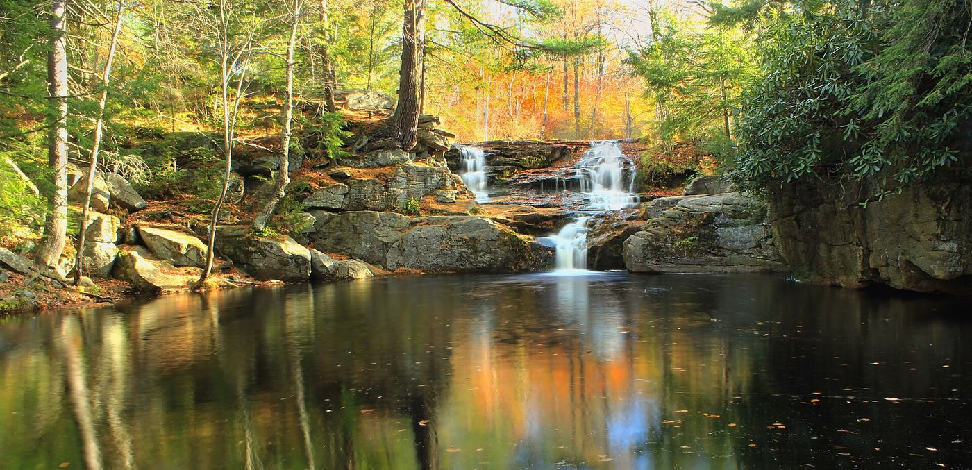
Photo credit
Photo: Nicholas A. Tonelli from Northeast Pennsylvania, USA, CC BY 2.0, via Wikimedia CommonsChoke Creek Falls, about 20 feet, tumbles into a deep pool in Pinchot State Forest. From the pull-off, walk past the gate and down the access road, passing a road on the left, for about a quarter mile to a clearing. Take the trail past the gate on the right, which heads downhill, for another quarter mile to a wooden bridge over Butler Run just above its confluence with Choke Creek. Cross the bridge, follow the trail a few yards downstream, then bear right and follow Choke Creek upstream about a quarter mile to the top of the falls. This last section is part of the orange-blazed Pinchot Trail. Return the same way, or make Jeff Mitchell's 4-mile loop using the Butler Run and Choke Creek trails.
Plan your visit
Gated pull-off at the 90-degree turn on Phelps Road, old forest roads to the Butler Run bridge, then the trail up Choke Creek to the top of Choke Creek Falls
Uncovering PA describes three legs of about a quarter mile each from the gate to the falls and calls it a 3/4-mile walk. Jeff Mitchell describes a longer loop of about 4 miles that also passes the falls.
Mostly old forest roads, then a narrower, somewhat rougher footpath along the creek.
Where to start
Unmarked pull-off at a 90-degree turn on Phelps Road, 3.5 miles down well-maintained dirt roads in the Thornhurst Tract. Room for several cars; do not block the gate. Published coordinates: 41.174697, -75.609054.
Timing & water
No seasonal closure is mentioned. The falls are louder and fuller after rain.
Before you go
No fee is mentioned.
Visitor informationVisit sources
- Uncovering PA: Choke Creek Falls in Pinchot State Forest
- Uncovering PA: Choke Creek Falls in Pinchot State Forest
- Uncovering PA: Choke Creek Falls in Pinchot State Forest
- Uncovering PA: Choke Creek Falls in Pinchot State Forest
- Jeff Mitchell: Hike the Choke Creek Falls Loop, Pinchot State Forest
- Jeff Mitchell: Hike the Choke Creek Falls Loop, Pinchot State Forest
More waterfalls nearby
Within 40 straight-line miles. Road and trail distances will differ.
- Great Falls of the LehighMonroe County, PA3.0 miS
 Tobyhanna FallsEasy county natural area trail from Route 115Monroe County, PA6.3 miS
- Buttermilk FallsRoadside falls beside a pull-off; low flow in summer60 ft (18.3 m) · Luzerne County, PA6.5 miW
- Salvatore FallsPartial guide: the last 50 yards to the base are off trailLuzerne County, PA9.2 miNW
- Rattlesnake FallsLackawanna County, PA10 miN
- Hawk FallsOfficial state park trail and roadside trailhead parking documentedCarbon County, PA11 miS
- Buttermilk FallsFlat state park rail trail and parking documentedCarbon County, PA16 miSW
- Lukes FallsOfficial park rail trail and access area documented; short level walkCarbon County, PA16 miSW
- Nay Aug FallsCity park trail to a railed viewing platform20 ft (6.1 m) · Lackawanna County, PA16 miN