Tobyhanna Falls
Monroe County, Pennsylvania
Your visit at a glance
- Waterfall height
- Not recorded
- Location
- Monroe County, Pennsylvania
- Access status
- Easy county natural area trail from Route 115
- The walk
- About 0.4 to 0.5 mile each way
- Ground & access
- Mostly flat creekside trail with a few wet spots and small stream crossings, one without a bridge; footing can be tricky.
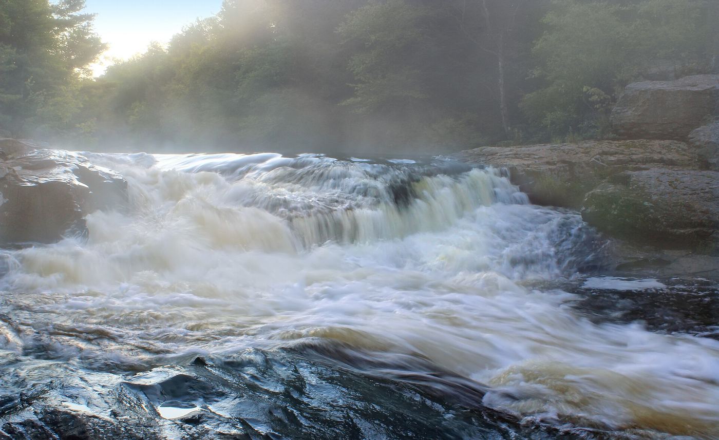
Photo credit
Photo: Nicholas A. Tonelli from Northeast Pennsylvania, USA, CC BY 2.0, via Wikimedia CommonsTobyhanna Falls is a small waterfall on Tobyhanna Creek in the Austin T. Blakeslee Natural Area, owned by Monroe County, just off I-80 exit 284. Park at the lot next to the Route 115 bridge over Tobyhanna Creek (the first lot when coming from I-80). From the end of the lot, follow the red-blazed trail along the north side of the creek through mixed forest, crossing small streams on bridges or stepping stones, for about half a mile to the falls. An overlook just beyond the falls gives a good view. Return the same way, or use the blue-blazed trail to loop back.
Plan your visit
Parking lot beside the Route 115 bridge over Tobyhanna Creek in the Austin T. Blakeslee Natural Area, red-blazed creekside trail to Tobyhanna Falls
PA Bucket List gives 0.4 mile one way; Uncovering PA says about half a mile from the parking area. Return the same way, or loop back on the blue-blazed trail.
Mostly flat creekside trail with a few wet spots and small stream crossings, one without a bridge; footing can be tricky.
Where to start
Lot next to the Route 115 bridge over Tobyhanna Creek, about half a mile from I-80 exit 284. Published coordinates: 41.083063, -75.584396. A second lot at the entrance has a pavilion and portable toilets.
Timing & water
PA Bucket List says the natural area is open from dawn until dusk year-round.
Before you go
No fee is mentioned.
Visitor informationVisit sources
- Uncovering PA: How to Get to Tobyhanna Falls in the Austin T. Blakeslee Natural Area
- Uncovering PA: How to Get to Tobyhanna Falls in the Austin T. Blakeslee Natural Area
- Uncovering PA: How to Get to Tobyhanna Falls in the Austin T. Blakeslee Natural Area
- Uncovering PA: How to Get to Tobyhanna Falls in the Austin T. Blakeslee Natural Area
- PA Bucket List: Exploring Tobyhanna Falls in Monroe County
- PA Bucket List: Exploring Tobyhanna Falls in Monroe County
More waterfalls nearby
Within 40 straight-line miles. Road and trail distances will differ.
- Great Falls of the LehighMonroe County, PA3.7 miNW
- Hawk FallsOfficial state park trail and roadside trailhead parking documentedCarbon County, PA5.8 miSW
 Choke Creek FallsForest roads and the Pinchot Trail from a Phelps Road pull-offLuzerne County, PA6.3 miN
- Buttermilk FallsRoadside falls beside a pull-off; low flow in summer60 ft (18.3 m) · Luzerne County, PA9.8 miNW
- Buttermilk FallsFlat state park rail trail and parking documentedCarbon County, PA12 miSW
- Lukes FallsOfficial park rail trail and access area documented; short level walkCarbon County, PA12 miSW
 Wild Creek FallsOfficial state park trail and trailhead documented; summer weekend parking limitsCarbon County, PA13 miS
- Salvatore FallsPartial guide: the last 50 yards to the base are off trailLuzerne County, PA15 miNW
- Rattlesnake FallsLackawanna County, PA16 miN