Yocum Falls
Clackamas County, Oregon
Your visit at a glance
- Waterfall height
- Not recorded
- Location
- Clackamas County, Oregon
- Access status
- Partial guide: final approach is an unmaintained user path
- The walk
- About 1.6 miles round trip (Wikipedia figure); final descent is a user path
- Ground & access
- Short maintained trail and old abandoned road, then a small unmaintained user path and scramble to the creek. Blowdowns were reported on nearby trails.
Yocum Falls is a series of cascades on Camp Creek in Mount Hood National Forest. From the Laurel Hill pullout, a stone stairway climbs to the old Mount Hood Highway, and the Laurel Hill Chute trail continues to an Oregon Trail marker. A hiker's trip report on Oregon Hikers describes walking down the old highway: at its last switchback the falls can be heard, and a small user trail leads down to the base. This is an informal user trail, and the report mentions scrambling back up from the falls. The upper tier and its lower drop are reachable; the middle section is hard to reach because of thick timber.
Plan your visit
Laurel Hill Chute Trailhead on Highway 26, up to the old Mount Hood Highway, then a user path down to Camp Creek
Wikipedia gives approximately 1.6 miles round trip from the historic Laurel Hill monument. The Oregon Hikers trip report gives no separate distance for the user path from the old highway switchback to the falls.
Short maintained trail and old abandoned road, then a small unmaintained user path and scramble to the creek. Blowdowns were reported on nearby trails.
Where to start
Laurel Hill Chute Trailhead: pull off Highway 26 at the large sign for the Historic Oregon Trail: Laurel Hill, 25.1 miles east of the last traffic light in Sandy. Oregon Hikers gives the trailhead at 45.31121, -121.80145.
Timing & water
No season limits are stated.
Before you go
No fee is mentioned for this pullout.
Visitor informationVisit sources
More waterfalls nearby
Within 40 straight-line miles. Road and trail distances will differ.
- Little Zigzag FallsResearched route and starting areaClackamas County, OR0.4 miN
- Paradise Branch Falls246 ft (75 m) · Clackamas County, OR4.5 miNE
- Sandy River FallsClackamas County, OR4.8 miN
- Middle Mimie FallsClackamas County, OR5.0 miNE
- Mimie FallsClackamas County, OR5.1 miNE
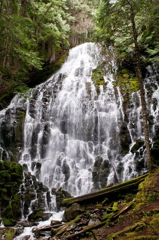 Ramona FallsResearched visit notes120 ft (36.5 m) · Clackamas County, OR5.1 miN
- Lower Dryer FallsHood River County, OR5.4 miE
- Upper Dryer FallsHood River County, OR5.5 miE
- Yocum Ridge FallsPartial guide: distant view from the Muddy Fork; name match to this listing is probable394 ft (120 m) · Clackamas County, OR6.0 miNE