Little Illinois River Falls
Josephine County, Oregon
Your visit at a glance
- Waterfall height
- 16 ft (5 m)
- Location
- Josephine County, Oregon
- Access status
- Short loop trail from a forest trailhead to riverside cataracts
- The walk
- One-mile loop from the Little Falls Trailhead
- Ground & access
- Rubbly switchbacks and a short scramble to the boulders. Poison oak, ticks and rattlesnakes. Trails can be sticky and muddy when wet.
Little Illinois River Falls is a set of small cataracts where the Illinois River narrows at a bend, in the Eight Dollar Mountain area off US 199. From the Little Falls Trailhead, walk the gravel path down to an obvious four-way junction on an old miner's ditch below the campground. Bear left and switchback twice down a rubbly trail to a rocky bluff above the river, then follow the trail downstream to the bend with the cataracts. A short scramble leads down to riverside boulders. The trail then rises back to the miner's ditch and the four-way junction; take the gravel path back up to the trailhead.
Plan your visit
Little Falls Trailhead on Eight Dollar Mountain Road (FR 4201) on the short loop down to the Illinois River
Oregon Hikers describes a one-mile loop down to the falls from the Little Falls Trailhead. Its longer 3.8-mile route starts at the Jeffrey Pine Trailhead.
Rubbly switchbacks and a short scramble to the boulders. Poison oak, ticks and rattlesnakes. Trails can be sticky and muddy when wet.
Where to start
Little Falls Trailhead day-use area above the restroom: from US 199, 33.6 miles south of Grants Pass, turn right on Eight Dollar Mountain Road (FR 4201) for 2.0 miles. Vault toilet and campground.
Timing & water
All year per Oregon Hikers. At very high river levels the falls are almost drowned.
Before you go
No fee is mentioned.
Visitor informationVisit sources
More waterfalls nearby
Within 40 straight-line miles. Road and trail distances will differ.
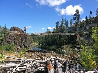 Illinois River Falls20 ft (6 m) · Josephine County, OR6.5 miNW
- Loretta FallsDel Norte County, CA19 miSE
- Rainie FallsEstablished BLM trail along the Rogue RiverJosephine County, OR29 miN
- Wilderness FallsSiskiyou County, CA31 miS
- Stair Creek FallsWilderness river trail to a cliff viewpoint across from the fallsCurry County, OR34 miN
- Granite FallsPartial guide: exact trails and distance from P-4 not describedJackson County, OR35 miE
- Ponytail FallsSiskiyou County, CA35 miSE
- Horsetail FallsPartial guide: exact roadside pull-out and road number not confirmedSiskiyou County, CA35 miSE
- Dillon Falls10 ft (3 m) · Jackson County, OR37 miNE