High Falls Waterfall
Columbia County, New York
Your visit at a glance
- Waterfall height
- Not recorded
- Location
- Columbia County, New York
- Access status
- Conservation area trail and parking documented
- The walk
- About 0.6 miles one way to the overlook
- Ground & access
- Dirt trail with a few short, steep grades; not suitable for wheelchairs.
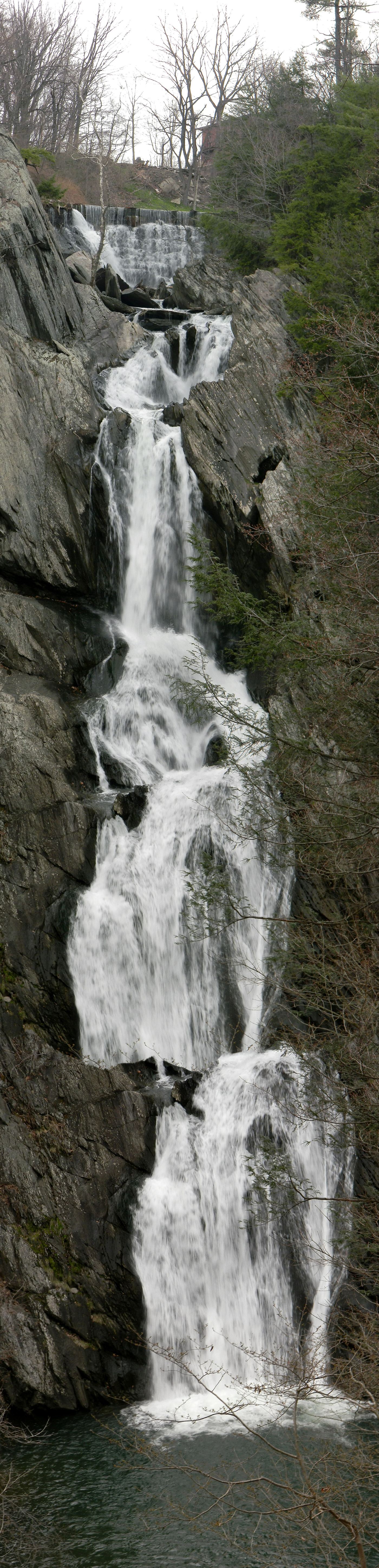
From the gravel lot on Roxbury Road, follow the green-blazed trail past a bench and over a bridge, then right. Stay on the green trail where the blue and red trails branch off. After about half a mile, including one small hill, it meets the red trail again; keep straight about a tenth of a mile to the end of the red trail at the only official viewpoint for the 150-foot falls on Agawamuck Creek. Return the same way or on the red trail.
Plan your visit
High Falls Conservation Area lot on Roxbury Road, Philmont, green-blazed trail to the red-blazed trail and the official High Falls overlook
Uncovering New York describes about half a mile on the green trail, then about a tenth of a mile further to the overlook. It gives 1.5 miles for all trails in the conservation area.
Dirt trail with a few short, steep grades; not suitable for wheelchairs.
Where to start
Gravel lot off Roxbury Road in Philmont with room for more than 20 cars; turn onto Roxbury Road from NY 217, cross the creek, and the entrance is shortly on the left (NYFalls coordinates N 42.24707 / W 73.65757).
Timing & water
Open daylight hours. The view can be overgrown in summer.
Before you go
Columbia Land Conservancy conservation area. NYFalls lists admission as free.
Visitor informationVisit sources
More waterfalls nearby
Within 40 straight-line miles. Road and trail distances will differ.
- Buttermilk FallsColumbia County, NY3.3 miSW
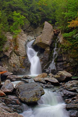 Bash Bish FallsSource-reviewed route and parkingBerkshire County, MA12 miSE
- Upper FallsOfficial trailhead and trail documented; exact upper drop not confirmedBerkshire County, MA16 miSE
- Lower FallsClub-documented trail from a free state trailheadBerkshire County, MA16 miSE
- Bear Rock FallsTrail hike on the Appalachian Trail; view from top only; short bushwhack299 ft (91 m) · Berkshire County, MA17 miSE
- Sages Ravine FallsAppalachian Trail hike to a series of small falls; exact mapped drop not confirmedBerkshire County, MA17 miSE
- Sages Ravine FallsGuidebook route on the Appalachian Trail; exact cascade not confirmedBerkshire County, MA17 miSE
- Dream WaterfallGreene County, NY17 miW
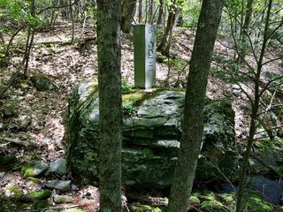 Sages Ravine Brook FallsAppalachian Trail route documented; exact mapped drop not confirmedBerkshire County, MA18 miSE