Salroc Fall
Coos County, New Hampshire
Your visit at a glance
- Waterfall height
- Not recorded
- Location
- Coos County, New Hampshire
- Access status
- National forest trail; under a mile from a major trailhead
- The walk
- About 0.6 miles each way
- Ground & access
- Moderate trail beside the brook; short scramble down to the upper falls. Rocks are slippery.
Salroc Falls is a two-part waterfall on Snyder Brook in White Mountain National Forest: a 7 foot lower drop among boulders and a 12 foot fan about 100 feet upstream. From the kiosk at the Appalachia Trailhead, go a few feet and turn left on the Presidential Rail Trail. After about 0.1 miles turn right on the yellow-blazed Fallsway Trail beside Snyder Brook. Pass Gordon Falls at 0.3 miles and the Maple Walk junction, and reach Lower Salroc Falls at about 0.6 miles. Continue about 100 feet on the trail and scramble down to the brook at Upper Salroc Falls. Return the same way; the trail network is confusing, so a map helps.
Plan your visit
Fallsway Trail from the Appalachia Trailhead on US 2, past Gordon Falls, to Salroc Falls on Snyder Brook
Waterfall Hero places Lower Salroc Falls at about 0.6 miles, with Upper Salroc Falls about 100 feet farther upstream.
Moderate trail beside the brook; short scramble down to the upper falls. Rocks are slippery.
Where to start
Appalachia Trailhead on the south side of US 2, about 5 miles west of the US 2 and NH 16 junction near Gorham. Forest Service coordinates: 44.37159, -71.288783. The lot fills quickly; Waterfall Hero says roadside parking on US 2 is allowed if the vehicle is completely off the road.
Timing & water
The Forest Service lists the trailhead as open 24 hours a day. Best May to October.
Before you go
New England Waterfalls lists no cost.
Visitor informationVisit sources
More waterfalls nearby
Within 40 straight-line miles. Road and trail distances will differ.
- Tama FallForest trail from a busy trailheadCoos County, NH0.1 miS
- Gordon FallNational forest trail from a free trailheadCoos County, NH0.3 miN
- Coosauk FallMarked national forest trail with a signed waterfallCoos County, NH0.9 miE
- Hitchcock FallClub-maintained forest trailCoos County, NH1.0 miSE
- Salmacis FallClub-maintained trail; rough footingCoos County, NH1.3 miS
- Chandler FallPartial guide: trail junctions and distance to the falls are not publishedCoos County, NH1.9 miSW
- Triple FallsShort steep forest trail beside a gorgeCoos County, NH2.1 miE
- Thompson FallsResearched route and starting areaCoos County, NH7.3 miSE
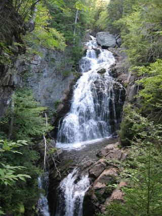 Crystal Cascades FallsNational forest trail to an overlook69 ft (21 m) · Coos County, NH7.3 miS