Chandler Fall
Coos County, New Hampshire
Your visit at a glance
- Waterfall height
- Not recorded
- Location
- Coos County, New Hampshire
- Access status
- Partial guide: trail junctions and distance to the falls are not published
- The walk
- Walking distance not published
- Ground & access
- Mountain trails with about 1,800 feet of climbing according to the trip report; steeper on the upper section.
Chandler Fall is on Spur Brook on the north slopes of Mount Adams in White Mountain National Forest. New England Waterfalls says the falls are visible from a short spur path off the Spur Trail. A trip report parked at Appalachia and used the Link, Amphibrach, Cliffway and Spur Trail, with views to the north from the top of the falls. Exact junctions and distances are not described, so carry a current White Mountains trail map.
Plan your visit
Appalachia Trailhead on US 2 in Randolph, Randolph Mountain Club trails to the Spur Trail, then a short spur path to a view of Chandler Fall
No source gives a trail distance to Chandler Fall. A trip report starting from Appalachia describes about 1,800 feet of climbing.
Mountain trails with about 1,800 feet of climbing according to the trip report; steeper on the upper section.
Where to start
Appalachia Trailhead on US 2, 5 miles west of the US 2 and NH 16 junction. The Forest Service page lists it as a fee site; the amount is not stated there.
Timing & water
The route description dates from 2013.
Before you go
The Forest Service page for the Appalachia Trailhead includes a fee site heading. Check current White Mountain National Forest parking pass rules.
Visitor informationVisit sources
More waterfalls nearby
Within 40 straight-line miles. Road and trail distances will differ.
- Salmacis FallClub-maintained trail; rough footingCoos County, NH1.2 miE
- Tama FallForest trail from a busy trailheadCoos County, NH1.8 miNE
- Salroc FallNational forest trail; under a mile from a major trailheadCoos County, NH1.9 miNE
- Hitchcock FallClub-maintained forest trailCoos County, NH2.1 miNE
- Gordon FallNational forest trail from a free trailheadCoos County, NH2.2 miNE
- Coosauk FallMarked national forest trail with a signed waterfallCoos County, NH2.3 miNE
- Triple FallsShort steep forest trail beside a gorgeCoos County, NH3.2 miNE
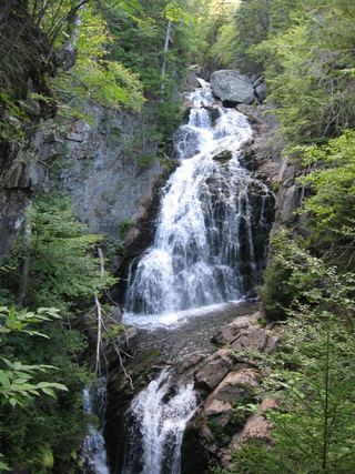 Crystal Cascades FallsNational forest trail to an overlook69 ft (21 m) · Coos County, NH6.0 miSE
- Thompson FallsResearched route and starting areaCoos County, NH6.3 miSE