Hitchcock Fall
Coos County, New Hampshire
Your visit at a glance
- Waterfall height
- Not recorded
- Location
- Coos County, New Hampshire
- Access status
- Club-maintained forest trail
- The walk
- About 2 miles return
- Ground & access
- Moderate climb to Coosauk Fall, then a narrow, steep, often muddy trail to Hitchcock Fall. Boulders around the falls.
Follow the combined Howker Ridge Trail and Randolph Path through a field into the forest. At about 0.1 miles, go left on Howker Ridge Trail and cross an old logging road. Pass Stairs Fall across the brook and Coosauk Fall at about 0.7 miles. Just past Coosauk Fall fork left on Howker Ridge Trail, and about 0.1 miles farther fork left again where the Kelton Trail goes right. Hitchcock Fall is a few minutes ahead. Return the same way.
Plan your visit
Randolph East trailhead on Dolly Copp Road (Pinkham B Road) near US 2, Howker Ridge Trail past Stairs Fall and Coosauk Fall to Hitchcock Fall
The Randolph Mountain Club lists the Bumpus Brook walk to Stairs, Coosauk and Hitchcock Falls as 2.0 miles round trip.
Moderate climb to Coosauk Fall, then a narrow, steep, often muddy trail to Hitchcock Fall. Boulders around the falls.
Where to start
Forest Service trailhead parking on Dolly Copp Road about 0.1 miles south of US 2 in Randolph. Look for the Forest Service hiker sign; the larger lot for the Presidential Range Rail Trail is a different lot.
Timing & water
No closure is stated by the sources.
Before you go
White Mountain National Forest. No fee is stated by the sources.
Visitor informationVisit sources
More waterfalls nearby
Within 40 straight-line miles. Road and trail distances will differ.
- Coosauk FallMarked national forest trail with a signed waterfallCoos County, NH0.3 miN
- Tama FallForest trail from a busy trailheadCoos County, NH1.0 miW
- Salroc FallNational forest trail; under a mile from a major trailheadCoos County, NH1.0 miNW
- Salmacis FallClub-maintained trail; rough footingCoos County, NH1.1 miSW
- Gordon FallNational forest trail from a free trailheadCoos County, NH1.1 miNW
- Triple FallsShort steep forest trail beside a gorgeCoos County, NH1.2 miE
- Chandler FallPartial guide: trail junctions and distance to the falls are not publishedCoos County, NH2.1 miSW
- Thompson FallsResearched route and starting areaCoos County, NH6.6 miS
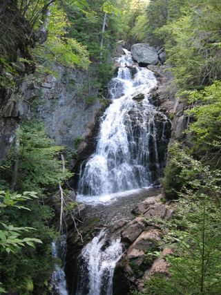 Crystal Cascades FallsNational forest trail to an overlook69 ft (21 m) · Coos County, NH6.8 miS