Garfield Falls
Coos County, New Hampshire
Your visit at a glance
- Waterfall height
- Not recorded
- Location
- Coos County, New Hampshire
- Access status
- Short trail on private land open to the public; remote gravel road access
- The walk
- About 0.3 miles each way
- Ground & access
- Packed earth trail with roots and steep log steps near the falls. Remote area on gravel logging roads.
Garfield Falls is a 35 to 40 foot plunge into a gorge on the East Branch of the Dead Diamond River in the Connecticut Lakes region. From US 3 north of Pittsburg village, turn right on Magalloway Road. After 9.6 miles take a sharp right to stay on Magalloway Road, then after 1 mile go straight onto Garfield Falls Road. The trailhead, with toilets and a state kiosk, is 1.3 miles farther. The trail starts fairly flat, then descends beside the falls on roots and log steps to the base and a view of the gorge. Return the same way.
Plan your visit
Garfield Falls trail from the trailhead kiosk on Garfield Falls Road, off Magalloway Road north of Pittsburg
Trail Finder gives a 0.3 mile trail and 0.6 miles round trip.
Packed earth trail with roots and steep log steps near the falls. Remote area on gravel logging roads.
Where to start
Designated parking at the Garfield Falls trailhead on Garfield Falls Road. NH State Parks asks visitors to park in designated areas and be prepared for gravel roads.
Timing & water
Gravel roads; best late May to early October.
Before you go
Trail Finder lists no fee. New England Waterfalls says the land is private but the public is welcome.
Visitor informationVisit sources
More waterfalls nearby
Within 40 straight-line miles. Road and trail distances will differ.
- Little HellgateBuilt trail off remote logging roads; public welcomeCoos County, NH2.9 miW
- Baby FlumeState park roadside stop and short pathCoos County, NH14 miSW
- Huntington CascadesShort marked state park trail from a waysideCoos County, NH15 miSW
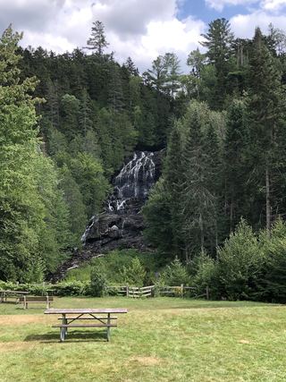 Beaver Brook FallsState wayside; roadside viewCoos County, NH19 miSW
- Angel FallsPublished trail with parking coordinates; stream crossings and logging roadFranklin County, ME26 miSE
- Pond Brook FallsShort Cohos Trail section from a seasonal forest roadCoos County, NH27 miSW
- Crystal FallsPartial: falls on private land; roadside view; path permission not confirmedCoos County, NH30 miS
- Sarampus FallsRoadside rest area viewpoint documentedFranklin County, ME31 miNE
- Shadagee FallsFranklin County, ME31 miNE