Waterfalls near Scranton, PA
12 named waterfalls within 30 miles of Scranton, closest first. Distances are straight-line from the town center.
Visits with route details
Read the walking route, starting point and current access notes.
- Nay Aug FallsCity park trail to a railed viewing platform20 ft (6.1 m) · Lackawanna County, PA
- Salvatore FallsPartial guide: the last 50 yards to the base are off trailLuzerne County, PA
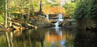 Choke Creek FallsForest roads and the Pinchot Trail from a Phelps Road pull-offLuzerne County, PA
- Buttermilk FallsRoadside falls beside a pull-off; low flow in summer60 ft (18.3 m) · Luzerne County, PA
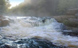 Tobyhanna FallsEasy county natural area trail from Route 115Monroe County, PA
- Carley Brook FallsPartial guide: viewed from a private business lot; parking for non-customers is not confirmedWayne County, PA
- Hawk FallsOfficial state park trail and roadside trailhead parking documentedCarbon County, PA
All 12 waterfalls
- Nay Aug FallsCity park trail to a railed viewing platform20 ft (6.1 m) · Lackawanna County, PA1.4 miE
- Rattlesnake FallsLackawanna County, PA6.6 miS
- Salvatore FallsPartial guide: the last 50 yards to the base are off trailLuzerne County, PA11 miSW
- Choke Creek FallsForest roads and the Pinchot Trail from a Phelps Road pull-offLuzerne County, PA17 miS
- Buttermilk FallsRoadside falls beside a pull-off; low flow in summer60 ft (18.3 m) · Luzerne County, PA17 miS
- Great Falls of the LehighMonroe County, PA19 miS
- Wangum FallsWayne County, PA22 miE
- Tobyhanna FallsEasy county natural area trail from Route 115Monroe County, PA23 miS
- Carley Brook FallsPartial guide: viewed from a private business lot; parking for non-customers is not confirmedWayne County, PA24 miNE
- Indian Ladder FallsPike County, PA25 miSE
- Bond Hill FallsMonroe County, PA26 miSE
- Hawk FallsOfficial state park trail and roadside trailhead parking documentedCarbon County, PA28 miS