Waterfalls near London, KY
26 named waterfalls within 30 miles of London, closest first. Distances are straight-line from the town center.
Visits with route details
Read the walking route, starting point and current access notes.
- Flat Lick FallsCounty park with paved overlook path; lower trail crosses creekJackson County, KY
- Bark Camp Branch FallsPartial guide: which small falls this is has not been confirmedWhitley County, KY
- Bark Camp Creek CascadesPublished route with matching coordinatesWhitley County, KY
- McCammon FallsShort unmarked trail from county park; rope-assisted descentJackson County, KY
- Dog Slaughter FallsOfficial open access from lower trailhead; creek ford required20 ft (6.1 m) · Whitley County, KY
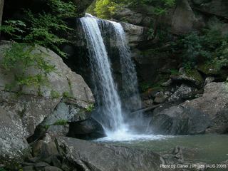 Eagle Creek FallsMarked state park trail with published GPS; closes in high waterMcCreary County, KY
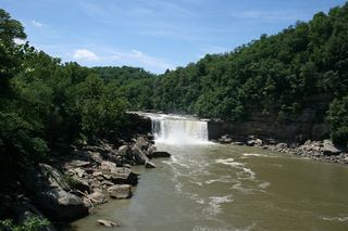 Cumberland FallsPaved short walk from visitors center to overlooks; some platforms may closeMcCreary County, KY
- Turkey Foot Loop Trail FallsPublished short loop with matching coordinatesJackson County, KY
- Anglin FallsOfficial preserve trail and parkingRockcastle County, KY
- Alcorn Branch FallsShort Sheltowee Trace walk described; parking and distance not confirmedJackson County, KY
All 26 waterfalls
- Pine Creek FallsLaurel County, KY11 miW
- 80 FallsLaurel County, KY11 miW
- Double FallsLaurel County, KY12 miW
- Vanhook FallsLaurel County, KY13 miSW
- Lick Branch FallsLaurel County, KY14 miSW
- Bee Creek Road FallsWhitley County, KY17 miSW
- Bear Creek FallsPulaski County, KY18 miSW
- Joe High FallsRockcastle County, KY18 miNW
- Pole Bridge Branch FallsPulaski County, KY18 miSW
- Flat Lick FallsCounty park with paved overlook path; lower trail crosses creekJackson County, KY18 miNE
- Dutch Branch FallsLaurel County, KY19 miSW
- Grandaddy WaterfallsWhitley County, KY19 miSW
- Boulder CascadeWhitley County, KY19 miSW
- Bark Camp Branch FallsPartial guide: which small falls this is has not been confirmedWhitley County, KY19 miSW
- Bark Camp FallsWhitley County, KY19 miSW
- Bark Camp Creek CascadesPublished route with matching coordinatesWhitley County, KY20 miSW
- McCammon FallsShort unmarked trail from county park; rope-assisted descentJackson County, KY20 miNE
- Devil Creek WatefallMcCreary County, KY20 miSW
- Star Creek FallsWhitley County, KY21 miSW
- Dog Slaughter FallsOfficial open access from lower trailhead; creek ford required20 ft (6.1 m) · Whitley County, KY23 miSW
- Eagle Creek FallsMarked state park trail with published GPS; closes in high waterMcCreary County, KY24 miSW
- Cumberland FallsPaved short walk from visitors center to overlooks; some platforms may closeMcCreary County, KY25 miSW
- Turkey Foot Loop Trail FallsPublished short loop with matching coordinatesJackson County, KY25 miN
- Anglin FallsOfficial preserve trail and parkingRockcastle County, KY27 miN
- Wind Cave CascadesJackson County, KY28 miN
- Alcorn Branch FallsShort Sheltowee Trace walk described; parking and distance not confirmedJackson County, KY29 miN