Waterfalls near Lincolnton, NC
13 named waterfalls within 30 miles of Lincolnton, closest first. Distances are straight-line from the town center.
Visits with route details
Read the walking route, starting point and current access notes.
- Little River FallsPartial guide: final approach is a steep bushwhack near a dangerous cliff topBurke County, NC
- Granite FallsPartial guide: viewing platform exists but public access permission is unconfirmedCaldwell County, NC
- Pot Branch FallsShort walk on old roads in South Mountains Game Land; rough gravel road with a fordRutherford County, NC
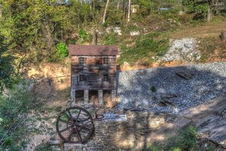 McGalliard FallsTown park with a short path; listed hours 8 AM to 8 PMBurke County, NC
- Sally Queen FallsPartial: bushwhack with no trail; storm blowdowns reportedRutherford County, NC
All 13 waterfalls
- High ShoalsGaston County, NC6.1 miSE
- Little Long Creek FallsGaston County, NC9.9 miS
- Long Creek FallsGaston County, NC12 miS
- Little River FallsPartial guide: final approach is a steep bushwhack near a dangerous cliff topBurke County, NC23 miNW
- Upper High Shoals FallsBurke County, NC23 miW
- High Shoals FallsBurke County, NC23 miW
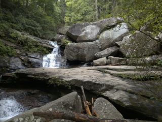 Big Bear FallsBurke County, NC23 miNW
- Granite FallsPartial guide: viewing platform exists but public access permission is unconfirmedCaldwell County, NC24 miN
- Beautimos FallsCleveland County, NC25 miW
- Black Mountain FallsRutherford County, NC26 miW
- Pot Branch FallsShort walk on old roads in South Mountains Game Land; rough gravel road with a fordRutherford County, NC27 miW
- McGalliard FallsTown park with a short path; listed hours 8 AM to 8 PMBurke County, NC27 miNW
- Sally Queen FallsPartial: bushwhack with no trail; storm blowdowns reportedRutherford County, NC28 miW