Great Falls
Litchfield County, Connecticut
Your visit at a glance
- Waterfall height
- 49 ft (15 m)
- Location
- Litchfield County, Connecticut
- Access status
- Partial guide: overlook location official; walking distance from parking not published
- The walk
- Short walk; distance not published
- Ground & access
- Riverside overlook and Appalachian Trail footpath. The ravine below the dam has rough boulders and powerful water; stay on trails.
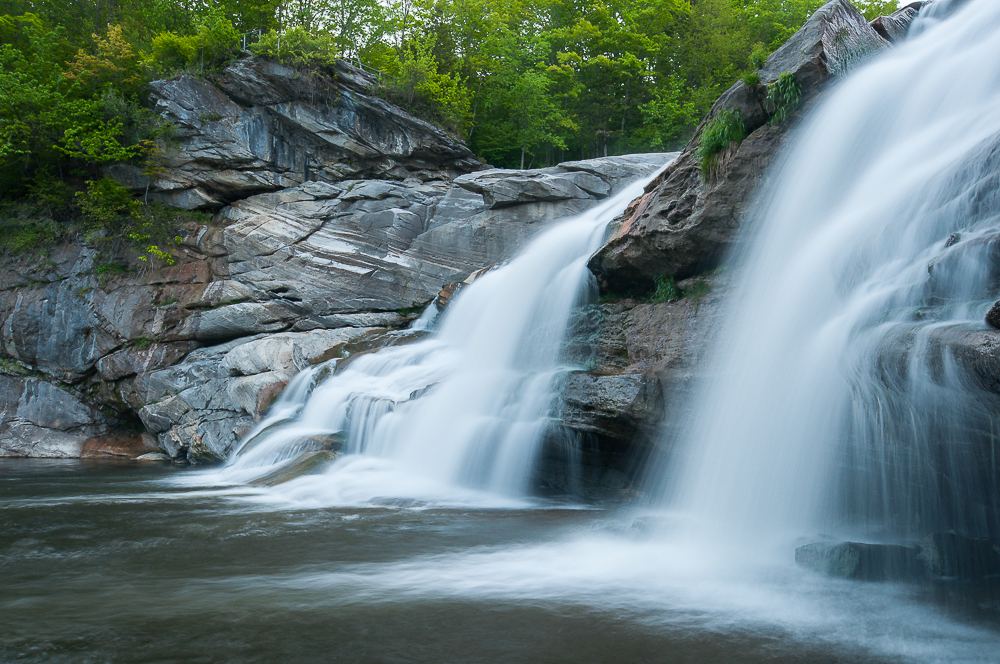
FirstLight, which runs the Falls Village hydro station, maintains an overlook of Great Falls in the Upper Falls Village Recreation Area. The Appalachian Trail passes the falls; CTMQ walked down the Appalachian Trail from the road to view them. A short Amesville interpretive loop is above the dam.
Plan your visit
Upper Falls Village Recreation Area to the FirstLight overlook of Great Falls on the Housatonic River
No source reviewed gives a measured walk from parking to the overlook. The 3/4-mile figure on the FirstLight page is for a separate interpretive trail at the lower area.
Riverside overlook and Appalachian Trail footpath. The ravine below the dam has rough boulders and powerful water; stay on trails.
Where to start
FirstLight lists the recreation area at 35 Water Street, Canaan, CT 06031. CTMQ notes there are a couple of parking areas and access trails. The exact lot to use for the overlook is not stated.
Timing & water
Flow depends on the hydro plant. CTMQ says that in summer, when the river is low, almost all the water is diverted and the falls become a trickle. Best after snowmelt or storms.
Before you go
No fee or reservation is stated on the FirstLight page.
Visitor informationVisit sources
More waterfalls nearby
Within 40 straight-line miles. Road and trail distances will differ.
- Dean's Ravine FallsVisitor route and parking documented; distance not measured49 ft (15 m) · Litchfield County, CT3.3 miSE
- CascadeLitchfield County, CT3.4 miSE
- Riga Falls26 ft (8 m) · Litchfield County, CT5.3 miNW
- Pothole FallsLitchfield County, CT5.9 miSE
 Sages Ravine Brook FallsAppalachian Trail route documented; exact mapped drop not confirmedBerkshire County, MA6.7 miNW
- Pine Swamp Brook FallsRoadside view and pull-off documented; walk along a busy highwayLitchfield County, CT6.7 miS
- Sages Ravine FallsGuidebook route on the Appalachian Trail; exact cascade not confirmedBerkshire County, MA7.1 miNW
- Sages Ravine FallsAppalachian Trail hike to a series of small falls; exact mapped drop not confirmedBerkshire County, MA7.3 miNW
- Bear Rock FallsTrail hike on the Appalachian Trail; view from top only; short bushwhack299 ft (91 m) · Berkshire County, MA7.6 miNW