Salmon Creek Falls
Tulare County, California
Your visit at a glance
- Waterfall height
- Not recorded
- Location
- Tulare County, California
- Access status
- Partial guide: trail ends above the falls; full view needs scrambling
- The walk
- About 8 miles return from Horse Meadow
- Ground & access
- Forest trail with a creek crossing and a 400-foot drop near the west end. Beyond the trail end the terrain is steep granite; scrambling is for experienced hikers only.
The Forest Service trail starts at the entrance to Horse Meadow Campground, crosses the meadow and follows the south side of Salmon Creek about four miles to the falls. Kern River Sierra says the trail ends where the terrain steepens near the top of the falls. Seeing the main drops requires scrambling beyond the trail end.
Plan your visit
Salmon Creek Trail 33E36 from Horse Meadow to the trail end above Salmon Creek Falls
The Forest Service gives about eight miles round trip from the Horse Meadow Campground entrance. Kern River Sierra gives 4.6 miles return from a closer trailhead at the end of dirt road 23S08. Neither figure was measured here.
Forest trail with a creek crossing and a 400-foot drop near the west end. Beyond the trail end the terrain is steep granite; scrambling is for experienced hikers only.
Where to start
Forest Service: the trail starts at the entrance to Horse Meadow Campground off Cherry Hill Road. Kern River Sierra describes an alternative dirt parking area at the end of road 23S08. Road condition not verified.
Timing & water
Mountain roads may be closed by snow in winter; dates not verified. Best flow in spring.
Before you go
Day-use fee and permit requirements not stated in the reviewed sources.
Visitor informationVisit sources
More waterfalls nearby
Within 40 straight-line miles. Road and trail distances will differ.
- South Creek FallsPartial guide: roadside view only; safe walking space beside the road not verifiedTulare County, CA5.3 miNW
- Seven TeacupsPartial guide: exact roadside turnout not confirmed; creek crossingTulare County, CA6.4 miNW
- Alder Creek SlidesPost-fire access status unconfirmedTulare County, CA9.9 miNW
- Nobe Young FallsUnsigned use-trail route from a documented highway pulloutTulare County, CA10 miNW
- Peppermint Creek FallsLocal guide route from a documented pullout; private land downstream150 ft (45.7 m) · Tulare County, CA11 miN
- Cholollo FallsTulare County, CA16 miNW
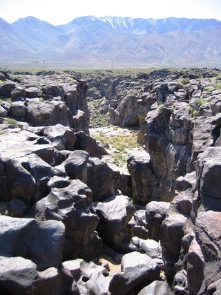 Fossil FallsPublished short route and parking documented; dry falls, cliff edgesInyo County, CA30 miE
- Volcano FallsTulare County, CA31 miN
- Tufa FallsPartial guide: falls are above the trail and screened by foliage; a clear viewpoint is not confirmedTulare County, CA38 miN