Roaring River Falls
Fresno County, California
Your visit at a glance
- Waterfall height
- Not recorded
- Location
- Fresno County, California
- The walk
- 0.10-mile approach
- Ground & access
- Wide paved path with slopes reaching 12%; a short distance does not mean level access.
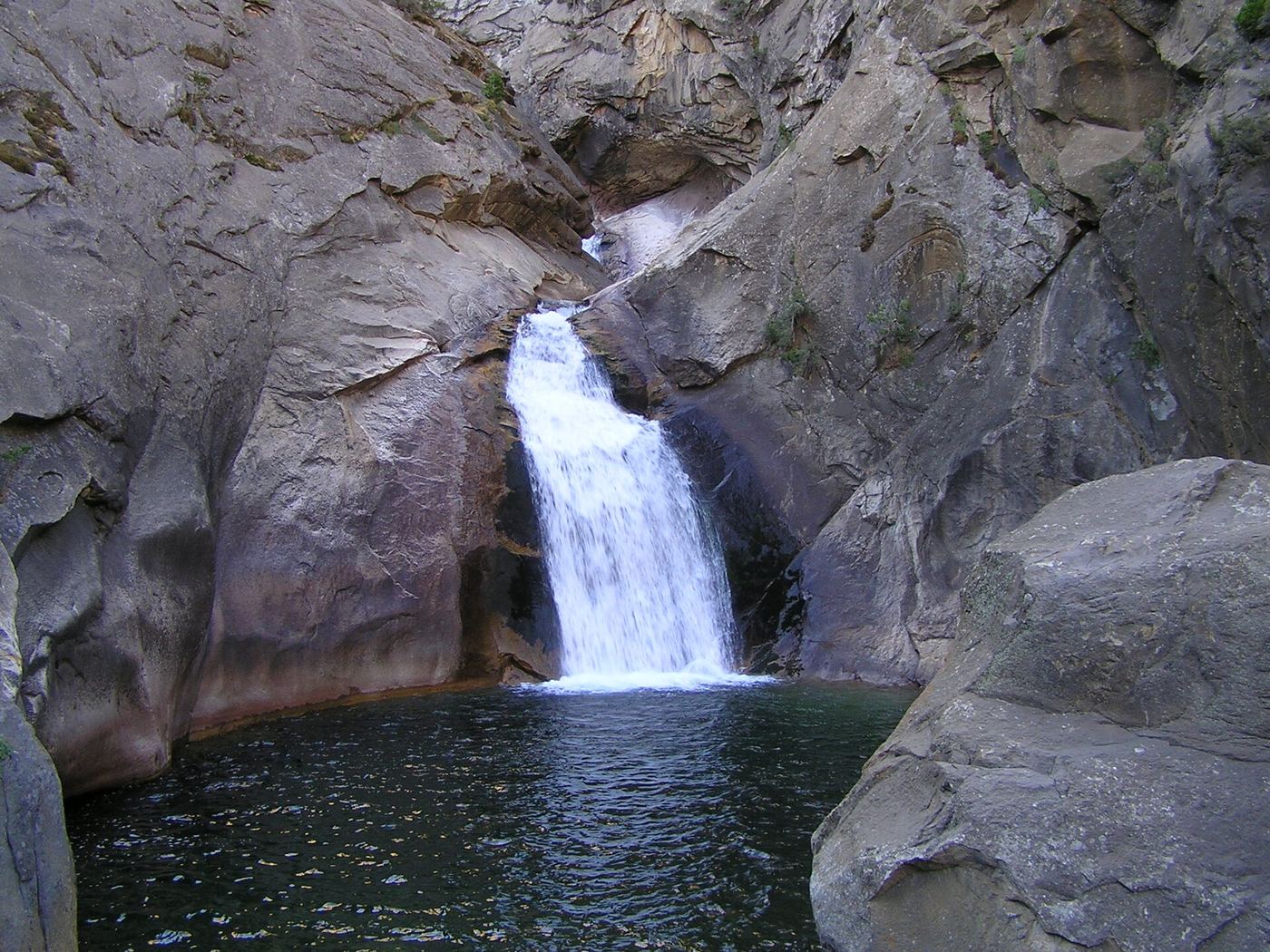
Follow the short paved path to a small viewing landing in Cedar Grove.
Plan your visit
Paved path to the falls landing
NPS describes a 0.10-mile path leading to the viewpoint, not a stated round-trip total.
Wide paved path with slopes reaching 12%; a short distance does not mean level access.
Where to start
The falls parking area has an accessible space directly in front of the path.
Timing & water
Cedar Grove road access is seasonal, typically May to early or mid-November. NPS conditions checked October 27, 2026 list Cedar Grove trails open.
Before you go
Current day-use booking requirements are not specified in the opened sources; confirm with the park.
Visitor informationVisit sources
More waterfalls nearby
Within 40 straight-line miles. Road and trail distances will differ.
- Mist FallsOfficial NPS trailFresno County, CA4.6 miNE
 Grizzly FallsPartial guide: picnic-area walk documented; parking unknown.Fresno County, CA6.9 miW
- Lower Gardiner FallsFresno County, CA9.4 miE
- Upper Gardiner FallsFresno County, CA9.5 miE
 Tokopah FallsResearched visit notesTulare County, CA12 miS
- Blue Canyon FallsFresno County, CA13 miNW
- Silver Spray FallsFresno County, CA13 miNW
- Upper Buck Creek FallsTulare County, CA14 miS
- Tamarack Falls52 ft (16 m) · Tulare County, CA14 miS