Lost Creek Falls
Bayfield County, Wisconsin
Your visit at a glance
- Waterfall height
- Not recorded
- Location
- Bayfield County, Wisconsin
- Access status
- Signed county forest trail with boardwalks from the Trail Drive trailhead
- The walk
- About 1.5 miles each way per a visitor account; another visitor review gives 3 miles round trip
- Ground & access
- Mostly easy, with gravel and boardwalk sections and about 200 feet of gradual elevation change. The trail can be slippery on downhill sections, and the last stretch down to the creek uses short switchbacks.
Lost Creek Falls is a small waterfall on Lost Creek No. 1 southwest of Cornucopia: an 8-foot plunge with cascades above and below, and a cove where you can walk behind the falls. Travel Wisconsin gives the address as Trail Drive, Cornucopia. Visitor accounts describe a well-marked trailhead on Trail Drive off County C just before Cornucopia, signs along the trail, crushed gravel and long raised boardwalks over wet areas. Near the end, a short series of switchbacks drops to the creek at the falls. Return the same way. Older guides describe a different trailhead on Klemik Road; this guide uses the Trail Drive trailhead.
Plan your visit
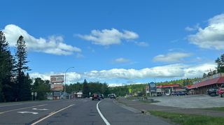
Lost Creek Falls trailhead on Trail Drive off County C near Cornucopia, along the signed trail and boardwalks, then down short switchbacks to the falls
AdamMartin.SPACE gives about 1.5 miles from the trailhead to the falls. A visitor review on The Outbound gives 3 miles round trip, out and back. These are visitor figures, not official measurements.
Mostly easy, with gravel and boardwalk sections and about 200 feet of gradual elevation change. The trail can be slippery on downhill sections, and the last stretch down to the creek uses short switchbacks.
Where to start
Trailhead parking on Trail Drive off County C near Cornucopia. A visitor review describes a larger parking area added during trail improvements; size is not stated.
Timing & water
No season or hours are stated.
Before you go
No fee is mentioned.
Visitor informationVisit sources
- Travel Wisconsin: Lost Creek Falls
- Travel Wisconsin: Lost Creek Falls
- The Outbound: Hike to Lost Creek Falls
- The Outbound: Hike to Lost Creek Falls
- The Outbound: Hike to Lost Creek Falls
- AdamMartin.SPACE: Lost Creek Falls
- AdamMartin.SPACE: Lost Creek Falls
- Perfect Duluth Day: Lost Creek Falls Trail in Bayfield County
More waterfalls nearby
Within 40 straight-line miles. Road and trail distances will differ.
- Siskiwit FallsPublic preserve with parking, boardwalks and short trails; land south of the road is privateBayfield County, WI1.9 miNE
- Lower FallsState park path documented20 ft (6 m) · Lake County, MN27 miNW
- Middle FallsPaved state park path documented23 ft (7 m) · Lake County, MN27 miNW
- Upper FallsShort accessible state park trail from the visitor center33 ft (10 m) · Lake County, MN27 miNW
- Fifth FallsPublished state park trail route and distance15 ft (4.5 m) · Lake County, MN27 miNW
- Lower FallsLake County, MN28 miNW
- Upper FallsLake County, MN28 miNW
 Beaver FallsRoadside view from the Highway 61 bridge walkwayLake County, MN31 miN
- Glenn Avon FallsVisitor directions documented; land ownership and parking permission unconfirmedLake County, MN32 miN