Upper Falls
Lake County, Minnesota
Your visit at a glance
- Waterfall height
- 33 ft (10 m)
- Location
- Lake County, Minnesota
- Access status
- Short accessible state park trail from the visitor center
- The walk
- Short paved walk; distance not published
- Ground & access
- Paved accessible trail near the falls; slippery rocks and cliffs around the falls.
Park at the Gooseberry Falls State Park visitor center on Highway 61. Take the short accessible trail to the Upper and Middle Falls. The paved trail passes under Highway 61 as it reaches the Upper Falls. Swimming is prohibited at the Upper Falls.
Plan your visit
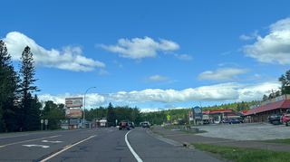
Gooseberry Falls State Park visitor center on the short accessible trail to the Upper Falls
The DNR map describes a short accessible trail from the visitor center to the Upper and Middle Falls but gives no distance. The longer Falls Loop Trail is 1 mile.
Paved accessible trail near the falls; slippery rocks and cliffs around the falls.
Where to start
Visitor center / DOT Wayside parking lot on Highway 61. The DNR map says vehicle permits are not required in this lot.
Timing & water
Park open 8 a.m. to 10 p.m. daily; the DOT Wayside is open 24 hours, per the DNR map.
Before you go
No vehicle permit needed at the visitor center / DOT Wayside lot per the DNR map. Permits are required elsewhere in the park.
Visitor informationVisit sources
More waterfalls nearby
Within 40 straight-line miles. Road and trail distances will differ.
- Middle FallsPaved state park path documented23 ft (7 m) · Lake County, MN0.1 miSE
- Lower FallsState park path documented20 ft (6 m) · Lake County, MN0.1 miSE
- Fifth FallsPublished state park trail route and distance15 ft (4.5 m) · Lake County, MN0.5 miNW
- Lower FallsLake County, MN6.1 miSW
- Upper FallsLake County, MN6.4 miSW
- Glenn Avon FallsVisitor directions documented; land ownership and parking permission unconfirmedLake County, MN10 miNE
 Beaver FallsRoadside view from the Highway 61 bridge walkwayLake County, MN11 miNE
- The CascadesPartial guide: a reported indefinite trail closure has not been confirmed or clearedLake County, MN18 miNE
- Two Step FallsState park trail and 175 stairs; permit rule not confirmed13 ft (4 m) · Lake County, MN19 miNE