Middle Falls
Lake County, Minnesota
Your visit at a glance
- Waterfall height
- 23 ft (7 m)
- Location
- Lake County, Minnesota
- Access status
- Paved state park path documented
- The walk
- About 0.1 mile each way (park guide figure)
- Ground & access
- Paved accessible path to the overlook. Rock ledges near the river are slippery.
From the Gooseberry Falls State Park visitor center, a brief paved, accessible path leads to Middle Falls, the most photographed falls in the park. Lower Falls is a short walk downstream and Upper Falls is under Highway 61 to the north.
Plan your visit
Gooseberry Falls visitor center paved path to Middle Falls
A park guide lists Middle Falls 0.1 mile from the visitor center on a paved path. Not an official DNR figure.
Paved accessible path to the overlook. Rock ledges near the river are slippery.
Where to start
Visitor center parking at Gooseberry Falls State Park, 3206 Highway 61 East, Two Harbors.
Timing & water
Open year round. Highest flow in spring.
Before you go
Minnesota state park vehicle permit required. No reservation needed for day use.
Visitor informationVisit sources
More waterfalls nearby
Within 40 straight-line miles. Road and trail distances will differ.
- Lower FallsState park path documented20 ft (6 m) · Lake County, MN0.0 miSE
- Upper FallsShort accessible state park trail from the visitor center33 ft (10 m) · Lake County, MN0.1 miNW
- Fifth FallsPublished state park trail route and distance15 ft (4.5 m) · Lake County, MN0.6 miNW
- Lower FallsLake County, MN6.1 miSW
- Upper FallsLake County, MN6.4 miSW
- Glenn Avon FallsVisitor directions documented; land ownership and parking permission unconfirmedLake County, MN10 miNE
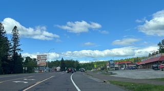 Beaver FallsRoadside view from the Highway 61 bridge walkwayLake County, MN11 miNE
- The CascadesPartial guide: a reported indefinite trail closure has not been confirmed or clearedLake County, MN18 miNE
- Two Step FallsState park trail and 175 stairs; permit rule not confirmed13 ft (4 m) · Lake County, MN19 miNE