Denny Camp Falls
King County, Washington
Your visit at a glance
- Waterfall height
- Not recorded
- Location
- King County, Washington
- Ground elevation
- About 2,325 ft above sea level
- Nearby mapped stream
- South Fork Snoqualmie River
- Land
- Snoqualmie National Forest
- Nearby mapped access
- Mapped trailhead (route unconfirmed)
A nearby mapped parking area or trailhead may not connect to this waterfall. Confirm the route and public access before travelling.
Denny Camp Falls is mapped in King County, Washington, 14.9 miles east of Tanner. This entry shows its location and nearby mapped places; a visitor route has not been confirmed.
About this location
Land & access
The land ownership record at this location lists Snoqualmie National Forest. The listed manager is U.S. Forest Service. The land record lists public access. Check the manager’s current visitor information for permitted routes and closures.
Nearby named trails
- Franklin Falls Trail
These paths are mapped within 250 metres (about 820 feet) of the waterfall. A connection to a viewpoint has not been verified.
Water & terrain
South Fork Snoqualmie River is mapped within 60 metres (about 200 feet) of the waterfall. Proximity alone does not confirm which stream feeds the falls.
Ground elevation is the land’s height above sea level, not the waterfall’s drop.
Sources for these details
Nearby streams and paths: OpenStreetMap. Land names: USGS PAD-US ownership records, with planning boundaries used only where ownership has no usable name. Ground elevation: USGS 3D Elevation Program.
Map records do not verify a walking route or current access conditions.
Before you make the trip
The closest mapped trailhead is 0.3 mi away in a straight line. This is not a walking distance.
Trail length, parking rules and current conditions have not been confirmed for this entry.
More waterfalls nearby
Within 40 straight-line miles. Road and trail distances will differ.
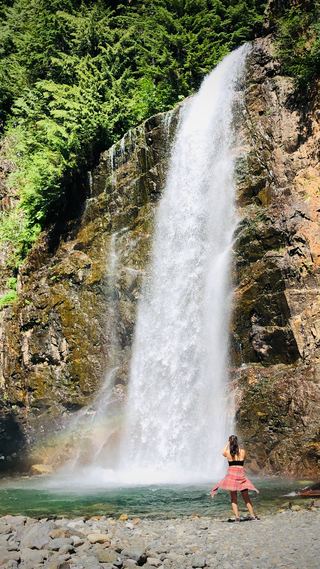 Franklin FallsResearched visit notes135 ft (41 m) · King County, WA0.5 miNE
- Keekwulee FallsNational forest wilderness trail with an unbridged creek ford171 ft (52.1 m) · King County, WA1.1 miNW
- Fall into the WallGuide: roadside view into the gorgeKing County, WA1.1 miNE
- Snowshoe FallsNational forest wilderness trail with an unbridged creek ford; partial view of the falls150 ft (45.7 m) · King County, WA1.3 miNW
- Rampart Falls644 ft (196.3 m) · Kittitas County, WA4.4 miE
- Laura FallsKittitas County, WA4.7 miE
- Rocky Run FallsKittitas County, WA4.7 miE
- Dingford Creek FallsPartial: short viewpoint near the trailhead from one visitor report; rough access roadKing County, WA6.8 miN
- Tin Cup Joe Falls463 ft (141.1 m) · King County, WA6.9 miN