Link Falls
Travis County, Texas
Your visit at a glance
- Waterfall height
- Not recorded
- Location
- Travis County, Texas
- Access status
- Partial guide: city park creek trail; exact start and distance not confirmed
- The walk
- No source gives a confirmed distance for this walk
- Ground & access
- Muddy, rocky creekside trail with many side paths and one or two crossings of Bull Creek. Water levels vary with rainfall. Mountain bikes share the trails.
Link Falls is a set of limestone ledge falls on Bull Creek in northwest Austin. A travel article places it at Bull Creek District Park and calls these ledge falls the biggest in the park, with a swimming hole beside them. The trail is muddy, has many winding paths, and crosses Bull Creek once or twice before the falls. Return the same way. This is a partial guide: the exact starting lot, the trail to follow and the walking distance are not confirmed by an official source, and this listing sits about 1 km north of the park's main area, so the falls may be reached from a greenbelt access point instead.
Plan your visit
Bull Creek District Park, 6701 Lakewood Drive, then the creekside trail along Bull Creek, crossing the creek once or twice, to Link Falls
The travel article read gives no distance. This listing is about 1 km north of the Bull Creek District Park point given by Wikipedia, which is not a walking distance.
Muddy, rocky creekside trail with many side paths and one or two crossings of Bull Creek. Water levels vary with rainfall. Mountain bikes share the trails.
Where to start
Parking at Bull Creek District Park on Lakewood Drive, with more access points along the Bull Creek Greenbelt. Parking can fill on busy weekends. Which lot is closest to the falls is not confirmed.
Timing & water
The travel article calls it one of the more reliable falls in Austin. A family guide says water levels vary with rainfall and advises not getting in the creek after heavy rain.
Before you go
Admission is free, per a family guide to the Bull Creek Greenbelt.
Visitor informationVisit sources
More waterfalls nearby
Within 40 straight-line miles. Road and trail distances will differ.
- Hidden FallsTravis County, TX0.4 miE
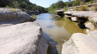 Middle Bull Creek FallsPartial guide: falls named by a park nonprofit; exact lot not statedTravis County, TX0.6 miSW
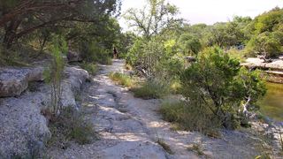 Lower Bull Creek FallsPartial guide: falls named by a park nonprofit; nearest lot not statedTravis County, TX0.9 miS
- Small FallsTravis County, TX5.1 miW
- Hill of Life FallsPartial guide: falls name not confirmed by an official source; steep descentTravis County, TX8.0 miS
- Sculpture FallsGuide: greenbelt trail past Twin FallsTravis County, TX8.5 miS
- Twin FallsShort greenbelt trail from Mopac street parking; flow depends on rainTravis County, TX9.2 miS
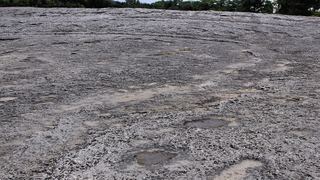 Lower McKinney FallsState park trail from the Lower Falls parking lot; entrance feeTravis County, TX14 miS
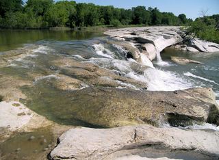 Upper McKinney FallsState park paved trail from the visitor center lot; entrance feeTravis County, TX14 miS