Suter Falls
Grundy County, Tennessee
Your visit at a glance
- Waterfall height
- Not recorded
- Location
- Grundy County, Tennessee
- Access status
- Guide: difficult trail into the Collins River gorge
- The walk
- 2 miles out and back, per Friends of the Parks
- Ground & access
- Difficult per the park and Friends of the Parks, with rock shelters and high bluffs along the way.
Suter Falls is on the Collins Gulf Trail in Savage Gulf State Park. From the Savage Gulf South (Collins Gulf) trailhead, walk 0.4 mile to the start of the Collins Gulf Trail, 0.2 mile past Collins West Campground; the Collins Rim Trail continues straight and the Collins Gulf Trail goes down and to the left. Follow it into the gorge along the Collins River to Suter Falls. The park says the trail can become impassable during ice buildup around Suter Falls and in high water. Return the same way, or continue 2 miles to Horsepound Falls.
Plan your visit
Savage Gulf South (Collins Gulf) trailhead, past Collins West Campground, down the Collins Gulf Trail along the Collins River to Suter Falls
Friends of the Parks describes a 2-mile out-and-back hike to Suter Falls. Tennessee State Parks says the Collins Gulf Trail begins 0.4 mile from the Collins West parking lot.
Difficult per the park and Friends of the Parks, with rock shelters and high bluffs along the way.
Where to start
Savage Gulf South trailhead (Collins Gulf), 2689 55th Ave, Gruetli-Laager, TN 37339. The park says this entrance has 15 parking spaces and no amenities.
Timing & water
Avoid during high water and icy periods; the park says the trail can become impassable then.
Before you go
No fee is mentioned. No booking is needed.
Visitor informationVisit sources
More waterfalls nearby
Within 40 straight-line miles. Road and trail distances will differ.
- Horsepound FallsGuide: difficult river-gorge trail past Suter FallsGrundy County, TN1.3 miN
- Savage FallsState park trail route and trailhead documentedGrundy County, TN3.3 miNE
- Ranger FallsPartial guide: trails and trailhead named; turn-by-turn route and distance to the falls not givenGrundy County, TN3.6 miW
- Greeter FallsState park trail route and trailhead documented; steep stairsGrundy County, TN5.8 miW
- Bridge Creek FallsMarion County, TN13 miS
- Pocket Creek FallsMarion County, TN13 miS
- Small WaterfallGrundy County, TN14 miSW
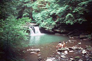 Blue Hole FallsState park trail route and trailhead documentedGrundy County, TN14 miSW
- Hanes Hole FallsState park loop trail and trailhead documentedGrundy County, TN14 miSW