Meigs Creek Cascade
Sevier County, Tennessee
Your visit at a glance
- Waterfall height
- Not recorded
- Location
- Sevier County, Tennessee
- Access status
- Park trail route documented; unbridged creek crossings; parking tag required
- The walk
- About 2 miles one way, 4.0 miles round trip, per The Outbound
- Ground & access
- Stone steps and a climb at the start, then creek crossings without footbridges that are easy in low water and tricky in high water. Rattlesnakes have been seen along the ridge section.
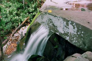
Meigs Creek Cascade, also called Upper Meigs Falls, is on Meigs Creek in Great Smoky Mountains National Park. The Meigs Creek Trail starts at The Sinks on Little River Road. It climbs stone steps, crests around 1 mile in, then descends to Meigs Creek and follows the creek upstream. The Outbound reports four creek crossings before the cascade, 2 miles in. There are no footbridges at the crossings. Return the same way, or continue toward Buckhorn Gap.
Plan your visit
The Sinks parking area on Little River Road, Meigs Creek Trail to Upper Meigs Falls (Meigs Creek Cascade)
The Outbound places the cascade 2 miles in and gives 4.0 miles round trip in its description; its summary box lists 3.55 miles. Hiking Project gives 3.5 miles for the whole Meigs Creek Trail to Buckhorn Gap, which goes past the cascade.
Stone steps and a climb at the start, then creek crossings without footbridges that are easy in low water and tricky in high water. Rattlesnakes have been seen along the ridge section.
Where to start
The Sinks parking area on Little River Road, 5.8 miles from the Townsend Y toward Sugarlands, or about 11.5 miles from Sugarlands Visitor Center. The lot can fill on summer weekends.
Timing & water
Hiking Project says the trail is closed when Little River Road is closed between the Townsend Y and Sugarlands Visitor Center.
Before you go
The National Park Service requires a parking tag for any vehicle parked in the park for longer than 15 minutes. A daily tag is $5.
Visitor informationVisit sources
More waterfalls nearby
Within 40 straight-line miles. Road and trail distances will differ.
- Meigs FallsRoadside national park viewpoint documentedBlount County, TN1.1 miNW
- Cane Creek Twin FallsRoadside view from a pull-off on Little River Road; parking tag requiredBlount County, TN2.1 miNW
- Spruce Flats FallsPartial guide: trail under repair with weekday and some full-week closuresBlount County, TN2.2 miSW
- Mannis Branch FallsPartial guide: roadside view only; exact pull-off not identifiedSevier County, TN2.2 miE
- Marks Creek FallsSevier County, TN2.7 miS
- Lynn Camp FallsGuide: easy trail walk to the cascadesSevier County, TN3.0 miS
- Meadow Branch CascadeBlount County, TN3.0 miW
 Laurel FallsTrail closedSevier County, TN3.9 miE
- Indian Flats FallsNational park trail route documented; short side path at the endSevier County, TN4.9 miS