Foster Falls 60
Marion County, Tennessee
Your visit at a glance
- Waterfall height
- Not recorded
- Location
- Marion County, Tennessee
- Access status
- State park viewing platform and trailhead documented
- The walk
- 0.2 miles round trip to the viewing platform, per Waterfall Record
- Ground & access
- Easy walk to the viewing platform. The trail to the base is short but steep. The viewpoint across the river has no barrier at the cliff edge.
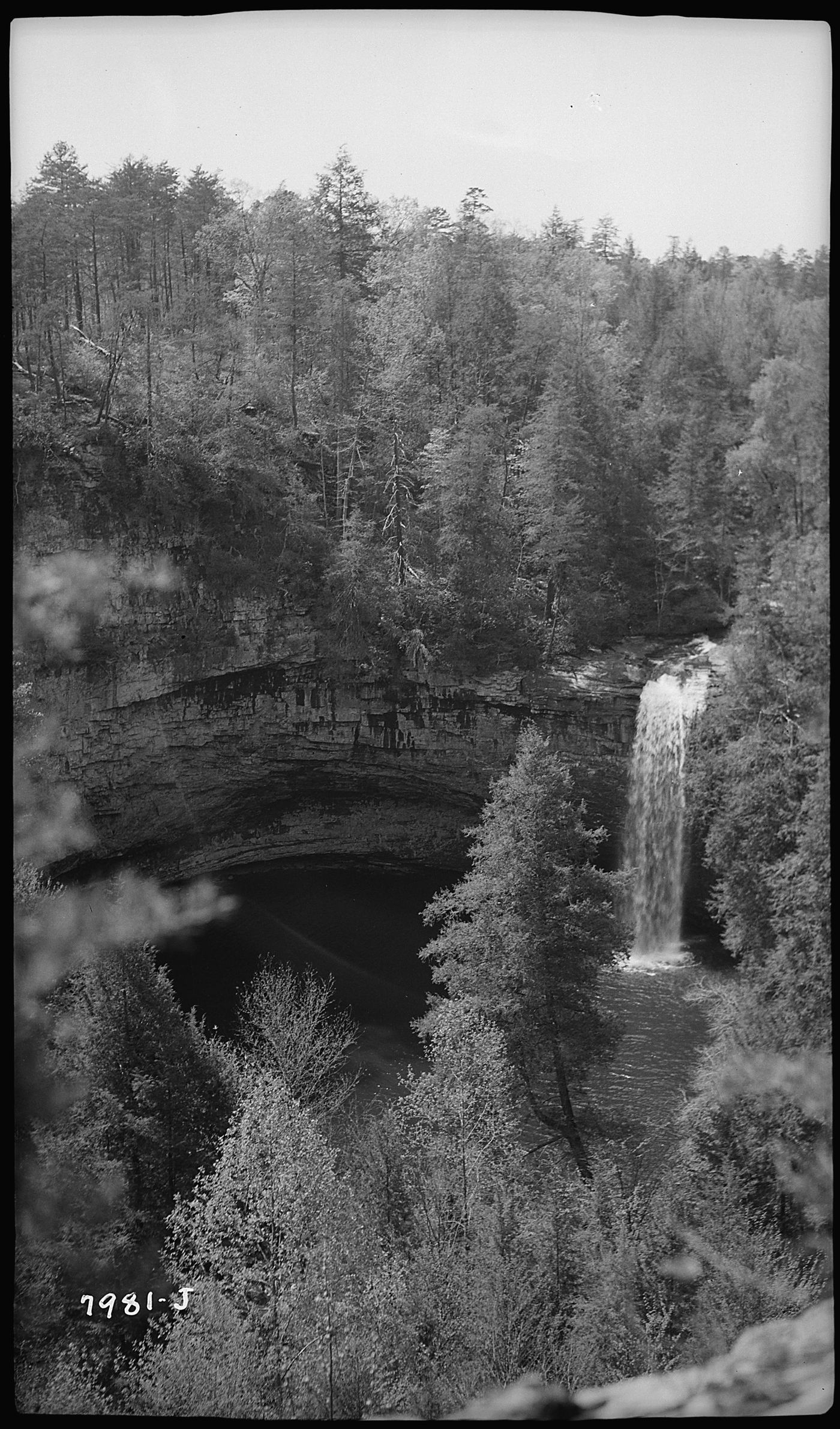
Photo credit
Photo: Tennessee Valley Authority, Public domain, via Wikimedia CommonsFoster Falls is a 60-foot waterfall on Little Gizzard Creek at the south end of the Fiery Gizzard Trail in Fiery Gizzard State Park. A viewing platform close to the parking area gives a view of the falls from a distance. A short, steep trail descends from near the platform and crosses a suspension bridge to the base, where the falls plunge into a deep pool. A third viewpoint is across the river on the Fiery Gizzard Trail; it has no fence or barrier at a drop of more than 60 feet. Horsehair Falls, a separate listing, is visible from that viewpoint.
Plan your visit
Fiery Gizzard South Trailhead (Foster Falls entrance) parking, short walk to the Foster Falls viewing platform
Waterfall Record gives 0.2 miles round trip for the viewing platform near the parking area. The base of the falls and the viewpoint across the river are separate, longer walks; no distances are given for them.
Easy walk to the viewing platform. The trail to the base is short but steep. The viewpoint across the river has no barrier at the cliff edge.
Where to start
Fiery Gizzard South Trailhead, Foster Falls entrance, 498 Foster Falls Road, off US 41, Sequatchie, TN.
Timing & water
Park hours are 8:00 AM to 30 minutes before sunset.
Before you go
No fee is mentioned.
Visitor informationVisit sources
More waterfalls nearby
Within 40 straight-line miles. Road and trail distances will differ.
- Horsehair Falls 80State park trail to viewpoint documented; unfenced cliff edgeMarion County, TN0.0 miE
- Small Falls 10Marion County, TN0.3 miN
- Ester FallsMarion County, TN0.7 miSW
- Denny Cove FallsGuide: difficult trail with boulder fields to the baseMarion County, TN2.0 miS
- Hemlock FallsMarion County, TN2.0 miS
- Chain FallsMarion County, TN4.0 miNW
- Anderson FallsMarion County, TN4.4 miNW
- Small WaterfallGrundy County, TN6.2 miNW
- Sycamore FallsState park trail route and trailhead documentedGrundy County, TN6.3 miNW