Angel Falls
Sullivan County, Pennsylvania
Your visit at a glance
- Waterfall height
- 70 ft (21.3 m)
- Location
- Sullivan County, Pennsylvania
- Access status
- Marked state forest trail and parking documented
- The walk
- About 1 mile each way (PA Bucket List figure)
- Ground & access
- Flat creekside trail, a wet crossing of Falls Run, then a steeper climb. Cliffs around the gorge; rocks near the falls are slippery.
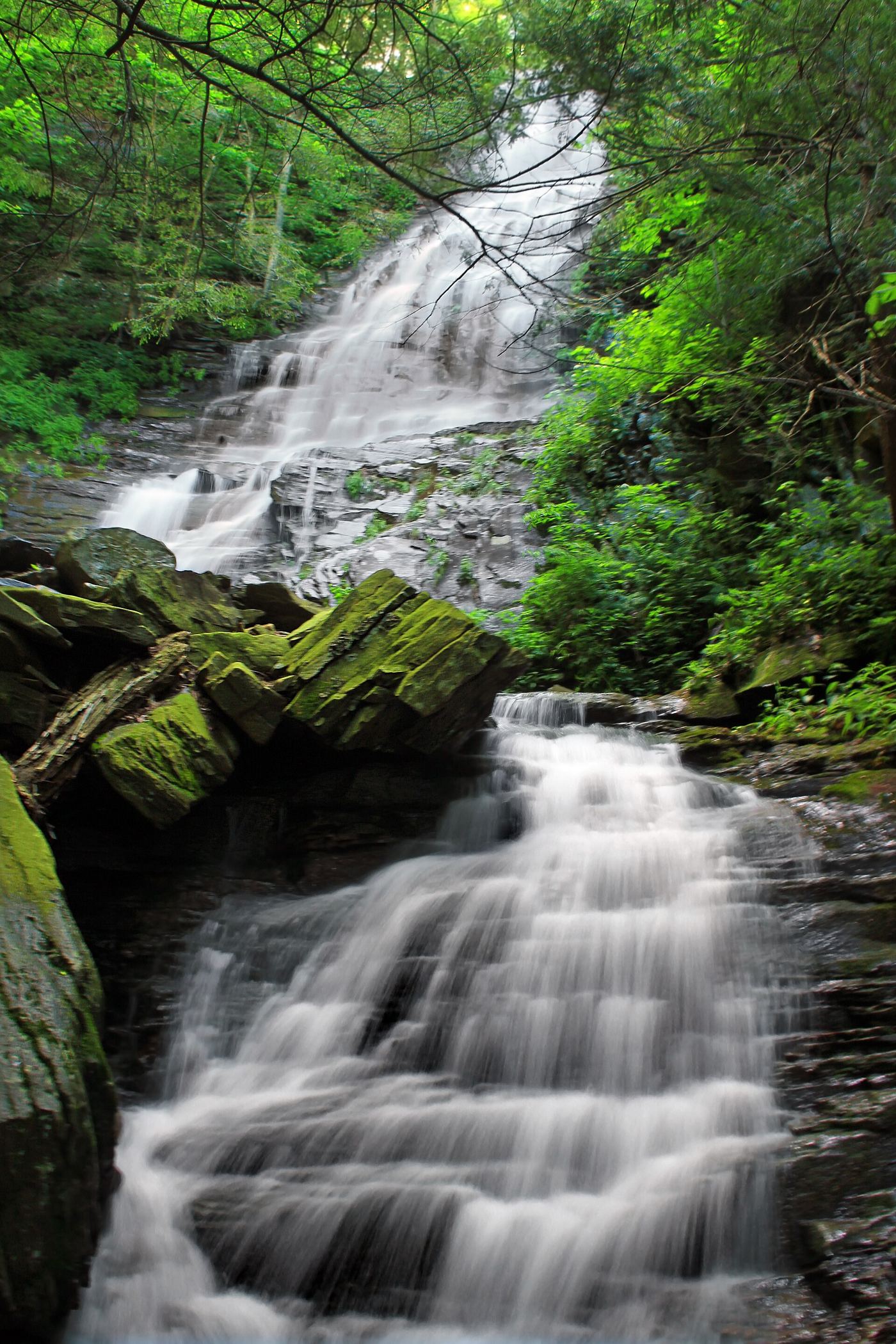
Photo credit
Photo: Nicholas A. Tonelli from Northeast Pennsylvania, USA, CC BY 2.0, via Wikimedia CommonsAngel Falls is a 70-foot falls on Falls Run in the southern part of Loyalsock State Forest. From the Brunnerdale Road lot, follow the Loyalsock Trail along Ogdonia Creek; the first two-thirds is nearly flat. At about one-third of a mile the trail follows a reroute; about one-third of a mile later it reaches a wet crossing of Falls Run. The last third of a mile climbs along Falls Run to Angel Falls. Blue spur-trail markers lead to Angel Falls and to 20-foot Gipson Falls just below it. Return the same way.
Plan your visit
Brunnerdale Road trailhead on the Loyalsock Trail along Ogdonia Creek, then the blue-blazed spur up Falls Run to Angel Falls
PA Bucket List gives a 1 mile hike along the Loyalsock Trail from the Brunnerdale Road lot to Angel Falls, then the same way back.
Flat creekside trail, a wet crossing of Falls Run, then a steeper climb. Cliffs around the gorge; rocks near the falls are slippery.
Where to start
Trailhead lot on Brunnerdale Road, published at 41.38518, -76.66822 (Uncovering PA gives 41.385239, -76.668308). Brunnerdale Road is a dirt road off Route 42.
Timing & water
Flow is often a trickle in summer; the falls are best during spring thaw or after heavy rain. The gorge forms large ice formations in winter.
Before you go
No fee is mentioned.
Visitor informationVisit sources
More waterfalls nearby
Within 40 straight-line miles. Road and trail distances will differ.
 Gipson FallsMarked Loyalsock Trail and spur from a trailhead lot20 ft (6.1 m) · Sullivan County, PA0.1 miS
- Andrea FallsSullivan County, PA2.3 miN
- Dry Run FallsRoadside falls with a parking lot and picnic areaSullivan County, PA2.5 miN
- Old Bark FallsPartial guide: falls are off trail and not named in the sourcesSullivan County, PA2.6 miN
- Lee's FallsPartial guide: part of the approach is an unblazed path between the Ketchum Run Trail and the Loyalsock Trail13 ft (4 m) · Sullivan County, PA4.7 miNE
- Armstrong-Rode FallsPartial guide: source route uses an off-trail creek section; listing name differs from the source name10 ft (3 m) · Sullivan County, PA4.8 miNE
- Mill Creek FallsShort blazed trail from a forest road pull-off13 ft (4 m) · Sullivan County, PA5.0 miNW
- Wenonah FallsSullivan County, PA5.3 miE
- Cottonwood FallsShort marked loop trail from PA 154 near the Worlds End chapelSullivan County, PA6.7 miNE