Diamond Notch Falls
Greene County, New York
Your visit at a glance
- Waterfall height
- 15 ft (4.6 m)
- Location
- Greene County, New York
- Access status
- State wilderness trail; about a mile one way
- The walk
- About 1 mile one way
- Ground & access
- Moderate. Old road and woodland trail with uneven footing and short climbs. Rocks near the falls are slippery.
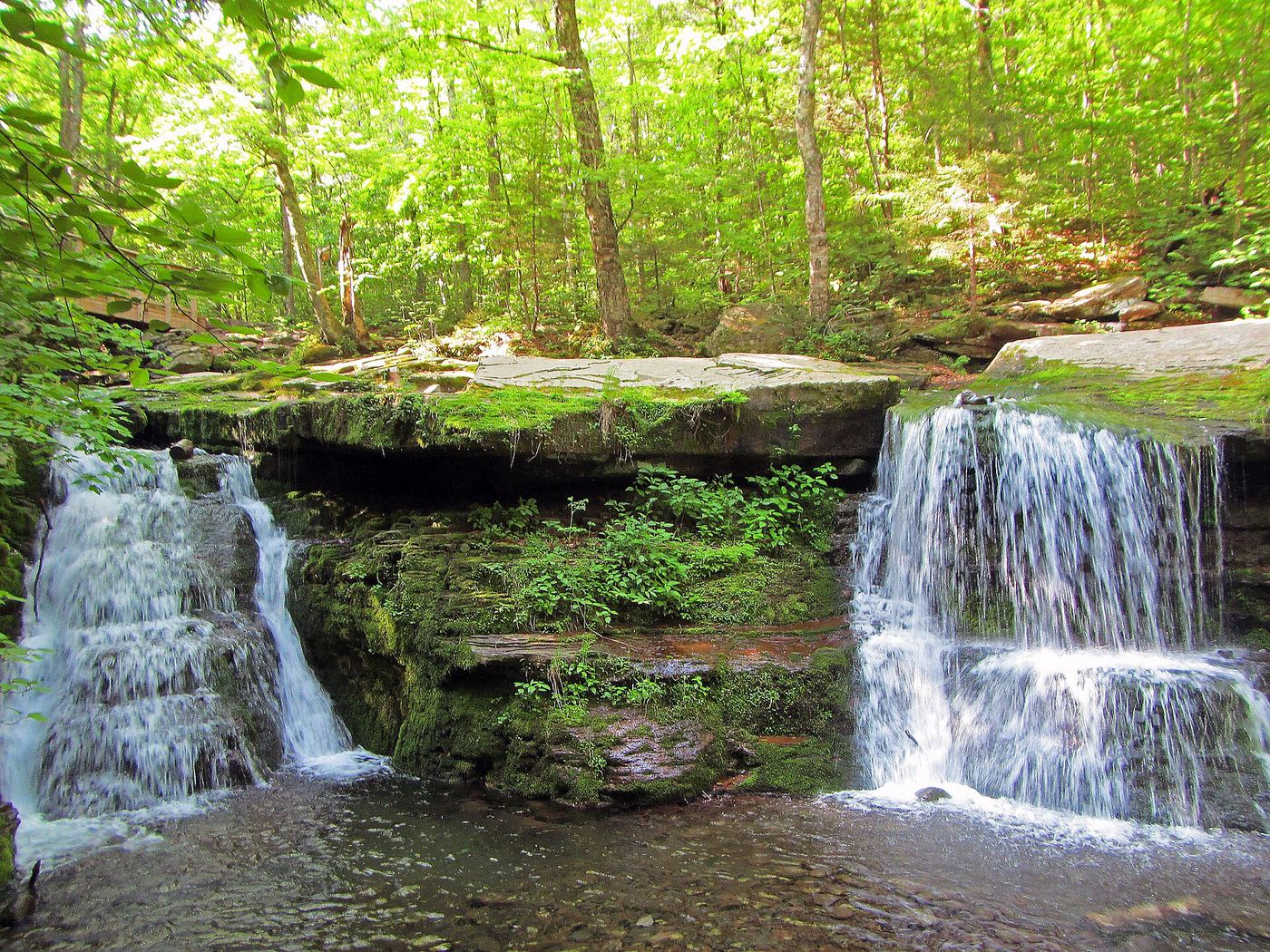
Photo credit
Photo: TheTurducken, with minimal editing by Daniel Case prior to upload, CC BY 2.0, via Wikimedia CommonsDiamond Notch Falls is a pair of side-by-side drops, each about 15 feet high, on the West Kill in the Hunter-West Kill Wilderness. From the parking lot, walk east past the end of Spruceton Road and a cabin, then follow the blue markers as the old road becomes a woodland trail. At about 0.8 to 1 mile you reach a wooden footbridge and the junction with the red-marked Devil's Path. The falls are just downstream of the bridge. A path leads down to the base. Return the same way.
Plan your visit
Diamond Notch parking lot near the end of Spruceton Road, blue-marked Diamond Notch Trail to the footbridge at Diamond Notch Falls
DEC says the Diamond Notch Trail passes Diamond Notch Falls at 1 mile from Spruceton Road. NYFalls gives just under a mile one way. Return the same way.
Moderate. Old road and woodland trail with uneven footing and short climbs. Rocks near the falls are slippery.
Where to start
DEC Diamond Notch Parking Lot near the end of Spruceton Road (County Route 6), 6.8 miles from NY 42. NYFalls says the gravel lot holds 8 to 10 cars. DEC coordinates: 42.182385, -74.269997.
Timing & water
DEC lists the area as open year-round. NYFalls says the flow can drop to a trickle in long dry spells, typically late summer and early fall.
Before you go
DEC lists the Hunter-West Kill Wilderness as free.
Visitor informationVisit sources
More waterfalls nearby
Within 40 straight-line miles. Road and trail distances will differ.
- Delmura FallsPartial guide: bushwhack approach; final route to the falls not described in detail13 ft (4 m) · Greene County, NY9.0 miE
- Santa Cruz Falls56 ft (17 m) · Greene County, NY9.0 miE
- Old Mill FallsPartial guide: view from the footbridge documented; walking distance from the parking area not given13 ft (4 m) · Greene County, NY9.3 miE
- Plattekill FallsShort preserve trail; dangerous drop-off at Hell's Hole75 ft (23 m) · Greene County, NY9.3 miE
- Bridal Veil FallsPartial guide: informal path to an unfenced cliff-edge lookout with many past deaths89 ft (27 m) · Greene County, NY9.4 miE
- Lower Bridal Veil Falls39 ft (12 m) · Greene County, NY9.4 miE
- Hells Hole FallsRoadside bridge view; private land around the falls39 ft (12 m) · Greene County, NY9.5 miE
- Upper Ghost (Japanese) Falls39 ft (12 m) · Greene County, NY9.5 miE
- Lower Ghost (Japanese) Falls75 ft (23 m) · Greene County, NY9.5 miE