Dawn Mist Falls
Glacier County, Montana
Your visit at a glance
- Waterfall height
- Not recorded
- Location
- Glacier County, Montana
- Access status
- Long national park trail to a spur; usually overnight
- The walk
- About 8 miles one way, about 16 miles return
- Ground & access
- Long hike. Steep descent in the first 2 miles, which is a climb on the way out. Suspension bridge crossing.
Dawn Mist Falls is a 50-foot falls in the remote Belly River valley of Glacier National Park, north of Elizabeth Lake. From the Chief Mountain Customs Trailhead, the Belly River Trail drops steeply for about 2 miles to the valley floor, then follows the valley south. Stay straight at the Cosley Lake Cutoff junction and cross the Belly River on a suspension bridge. Just after the crossing, turn at the signed junction for a short spur to the base of the falls. Return the same way. Many hikers make this an overnight trip; backcountry camping needs a permit.
Plan your visit
Chief Mountain Customs Trailhead on the Chief Mountain International Highway, Belly River Trail south across the suspension bridge to the short spur to Dawn Mist Falls
Enjoy Your Parks puts the spur to Dawn Mist Falls at mile 8.1 from the Chief Mountain Customs Trailhead; Discovering Montana gives 7.8 miles. Backpacker describes the spur as a 0.3-mile round trip detour. Usually done as an overnight trip.
Long hike. Steep descent in the first 2 miles, which is a climb on the way out. Suspension bridge crossing.
Where to start
Chief Mountain Customs Trailhead parking on the Chief Mountain International Highway near the Canada border.
Timing & water
Seasonal road and trail opening dates were not confirmed from a source read.
Before you go
Glacier National Park entrance fee applies; the standard entrance pass is $20 to $35. The park says no vehicle reservations are required in 2026. Overnight camping needs a backcountry permit.
Visitor informationVisit sources
More waterfalls nearby
Within 40 straight-line miles. Road and trail distances will differ.
- Gros Ventre FallsLong backcountry trail route; total distance combined from two sourcesGlacier County, MT1.7 miNW
- White Quiver FallsGlacier County, MT4.5 miW
- Miche Wabun FallsGlacier County, MT5.5 miNW
- Ipasha FallsLake approach documented; waterfall view unconfirmedGlacier County, MT5.7 miSW
- Mokowanis CascadeGlacier County, MT5.9 miW
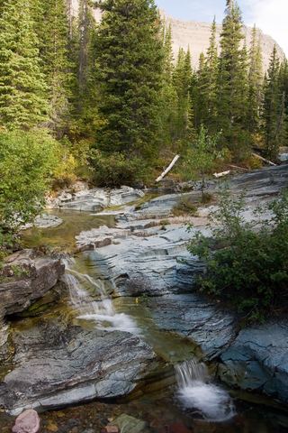 Ptarmigan FallsResearched visit notesGlacier County, MT6.0 miS
- Paiota FallsGlacier County, MT6.3 miSW
- Atsina FallsGlacier County, MT6.3 miW
- Raven Quiver FallsGlacier County, MT6.4 miSW