Big Falls
Cascade County, Montana
Your visit at a glance
- Waterfall height
- 89 ft (27 m)
- Location
- Cascade County, Montana
- Access status
- Partial guide: the sources call this waterfall The Great Falls; the Big Falls name is unconfirmed
- The walk
- Short walk from the parking area over the suspension bridge; length not published
- Ground & access
- Suspension bridge and island park paths. Visit Montana says the picnic area is handicapped accessible.
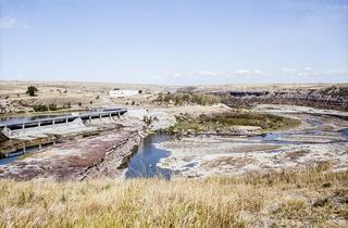
This waterfall is the falls below Ryan Dam on the Missouri River, which NPS calls The Great Falls. The reviewed sources do not use the name Big Falls. NPS says the best view is from the high point of Ryan Island Park, reached by a suspension bridge over the river at 160 Ryan Dam Road. The dam now controls the flow over the falls.
Plan your visit
Ryan Island Park viewpoint across the suspension bridge below Ryan Dam
No walking distance found. The driving directions in Visit Montana are road distances, not a walk.
Suspension bridge and island park paths. Visit Montana says the picnic area is handicapped accessible.
Where to start
Parking at the end of Ryan Dam Road (160 Ryan Dam Road). From Great Falls take US 87 north 3 miles, turn right on Morony Dam Road for 6.5 miles, then bear right on Ryan Dam Road.
Timing & water
Visit Montana lists the park open Mother's Day through Labor Day, daylight to dark. Outside that season the island park may be closed.
Before you go
Visit Montana says no reservations are needed for the picnic area. No fee found.
Visitor informationMore waterfalls nearby
Within 40 straight-line miles. Road and trail distances will differ.
- Crooked FallsTrail access documented; trailhead and distance unconfirmed19 ft (5.8 m) · Cascade County, MT4.1 miSW
 Rainbow FallsResearched walking route47 ft (14.3 m) · Cascade County, MT4.4 miSW
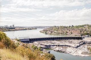 Black Eagle FallsViewing location documented; exact parking and walk unconfirmed26 ft (8.1 m) · Cascade County, MT7.4 miSW