Intermittent Cascade
Hartford County, Connecticut
Your visit at a glance
- Waterfall height
- Not recorded
- Location
- Hartford County, Connecticut
- Access status
- Preserve trail route documented
- The walk
- About 0.75 mile one way
- Ground & access
- Moderate woods trail with one stream crossing, usually ankle deep or less. The falls are seasonal (very small watershed).
From the preserve parking area, walk 150 feet on an old woods road and bear right at a fork. Follow the blue-and-red blazed trail, fork left at a second fork, and cross a small stream. At the plateau, take the right turn with the blazes. Descend 100 feet below the top of the falls for the best view. Return the same way.
Plan your visit
Ragged Mountain Memorial Preserve, West Lane, to Ragged Mountain Cascade
New England Waterfalls gives 0.75 mile one way, up 180 feet and down 60 feet.
Moderate woods trail with one stream crossing, usually ankle deep or less. The falls are seasonal (very small watershed).
Where to start
Ragged Mountain Memorial Preserve parking area or overflow areas on the right of West Lane, Berlin, 0.6 mile west of CT 71A.
Timing & water
Source suggests April to May; this small stream may be dry in other months.
Before you go
Free as of 2016 per source.
Visitor informationVisit sources
More waterfalls nearby
Within 40 straight-line miles. Road and trail distances will differ.
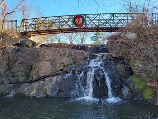 Mill Pond FallsTown park viewpoint and parking documentedHartford County, CT5.6 miNE
- Westfield FallsPartial guide: informal roadside parking; land ownership unconfirmedMiddlesex County, CT6.2 miSE
- CascadesPublished trail route documented; landowner not confirmedHartford County, CT6.3 miW
- Dividend FallsShort path from trailhead parking documentedHartford County, CT9.0 miE
- Spruce Glen FallsFirsthand land trust loop route and parking documentedNew Haven County, CT9.4 miS
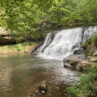 Wadsworth FallsState park falls with documented parking; fee at this lot not confirmed30 ft (9 m) · Middlesex County, CT9.6 miSE
 Wadsworth Little FallsOfficial park plus firsthand trail route; distance approximate39 ft (12 m) · Middlesex County, CT9.7 miSE
- Freeman Hill Brook FallsVisitor route documented; exact waterfall name match probableHartford County, CT10 miNW
- Whigville FallsHartford County, CT10 miNW