Cascade
Hartford County, Connecticut
Your visit at a glance
- Waterfall height
- Not recorded
- Location
- Hartford County, Connecticut
- Access status
- Published trail route and roadside parking documented
- The walk
- About 0.75 miles each way, about 1.5 miles return
- Ground & access
- Moderate. The source lists about 30 feet up and 100 feet down. Parts of the path are on a narrow, eroding slope that is slippery when wet or icy.
This point matches Flat Brook Falls, an 18-foot set of cascades on a tributary of Flat Brook in Glastonbury. Start where the blue-blazed Shenipsit Trail crosses Imperial Drive and hike downstream on the opposite side of the road. After about 0.4 mile cross a seasonal stream, continue 0.1 mile, then turn left onto a white-and-blue blazed trail. The falls are on the right after about 0.1 mile. Return the same way.
Plan your visit
Imperial Drive crossing of the Shenipsit Trail to Flat Brook Falls
New England Waterfalls gives a trail length of 0.75 mile one way. The return figure is derived by doubling it.
Moderate. The source lists about 30 feet up and 100 feet down. Parts of the path are on a narrow, eroding slope that is slippery when wet or icy.
Where to start
Roadside parking on Imperial Drive near the Shenipsit Trail crossing, 0.2 mile from Marlborough Road. The source says this is a somewhat busy residential street and suggests the start of Empress Road as another place to park. There is no parking lot at this start.
Timing & water
Best in April and May when the small tributary has water. Current trail conditions were not checked.
Before you go
The source listed no cost to visit (as of 2016). No reservation is mentioned.
Visitor informationVisit sources
More waterfalls nearby
Within 40 straight-line miles. Road and trail distances will differ.
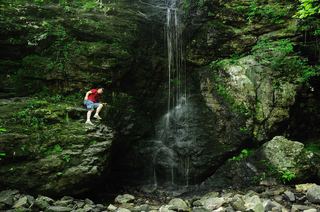 Blackledge FallsPartial guide: parking address and rules not confirmed from the townHartford County, CT1.5 miNE
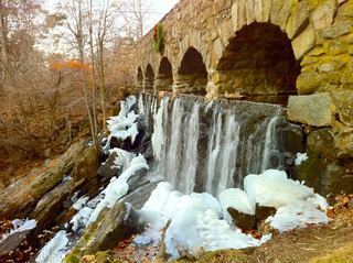 Case FallsFirsthand guide gives parking and short approachHartford County, CT5.4 miN
- Wyllys FallsPartial guide: no official trail; steep unmarked descentHartford County, CT5.4 miN
- CascadesPartial guide: route documented; non-resident access not confirmedHartford County, CT5.7 miW
- The CascadeMiddlesex County, CT6.5 miSW
- Center Springs FallsPublished park path and parking documentedHartford County, CT6.9 miN
- Grayville FallsGuidebook route and town park parking documentedNew London County, CT7.5 miSE
- Carr Brook FallsMiddlesex County, CT8.4 miSW
- Dividend FallsShort path from trailhead parking documentedHartford County, CT8.5 miW